
Marina gives me a somewhat desperate look after I tell her the remaining distance to Pontresina. And it's always a shame when that number is higher than you expected, your legs are starting to give out and your willpower isn't what it used to be. We've already covered around 20 kilometers, with about five more to go before our trail run through the Val Roseg, including a visit to the hut at the Chamanna Coaz in Pontresina, comes to an end.
Money out, altitude meters in
My legs are still a little tired, Marina tells me in the morning. They are tired from the ascent of the 3,380 m high Piz Julier, a rocky peak above the Julier Pass with impressive views over the Engadin. Hiking yesterday, trail running today - we don't want to get bored.
The planned route convinces us with a very humane number of meters in altitude (360 at the end of the run), a long descent and a long, relatively flat section on a mountain path on the northern side of the valley. The Val Roseg is always a bit tedious on foot, it's hardly any better on skis either because it's so flat and it's only really fun on a bike. But we're going to run, so it won't take so long...
There's still a bit of skepticism about our legs, but we take it easy and start with a ride from Camping Morteratsch to Silvaplana to the valley station of the Corvatsch cable car. You don't necessarily have to take the cable car to get to the 2,753 m high Fuorcla Surlej. Today, however, this option comes in handy. 900 meters further up and CHF 60 less, the gondola spits us out at the Murtèl mountain station and we find ourselves in a landscape that is obviously waiting for winter. But shortly after our start, we leave the wide ramps, construction sites and desolate scree slopes and run at a relaxed warm-up pace towards Fuorcla Surlej with only a small gain in altitude. A few flat hairpin bends await us before the view into Val Roseg opens up and we can see the north-eastern flanks of Piz Morteratsch, Piz Bernina, Piz Scerscen and Piz Roseg.
Your dream trail running tour
Would you like to experience your dream tour in the mountains as a trail run, but with the safety of a trained guide? We take care of the planning and organization for you and add the peace of mind that comes with being safe on the trail.

A river of debris
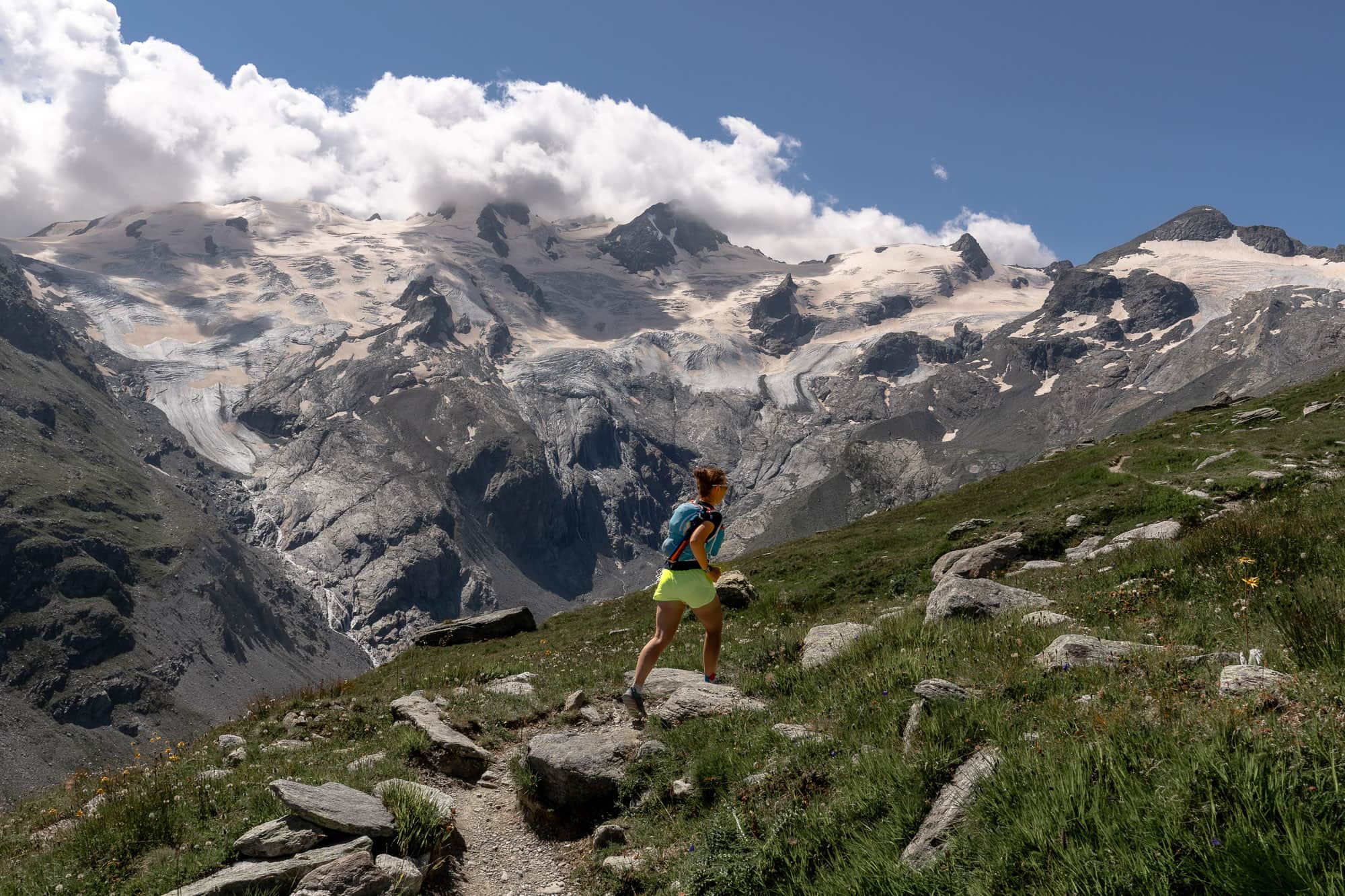
Our gaze inevitably falls on the seemingly oversized deposit area of the huge landslide on Piz Scerscen in spring 2024. The enormous extent is hard to imagine if you haven't seen it with your own eyes. An estimated eight to nine million cubic meters of debris broke away from the north-eastern flank of the almost 4,000-metre-high Piz Scerscen on 14 April 2024, and the accumulated debris cone is over five kilometers long. Miraculously, there was no damage to property or personal injury - in the middle of one of the best ski touring seasons in recent years.
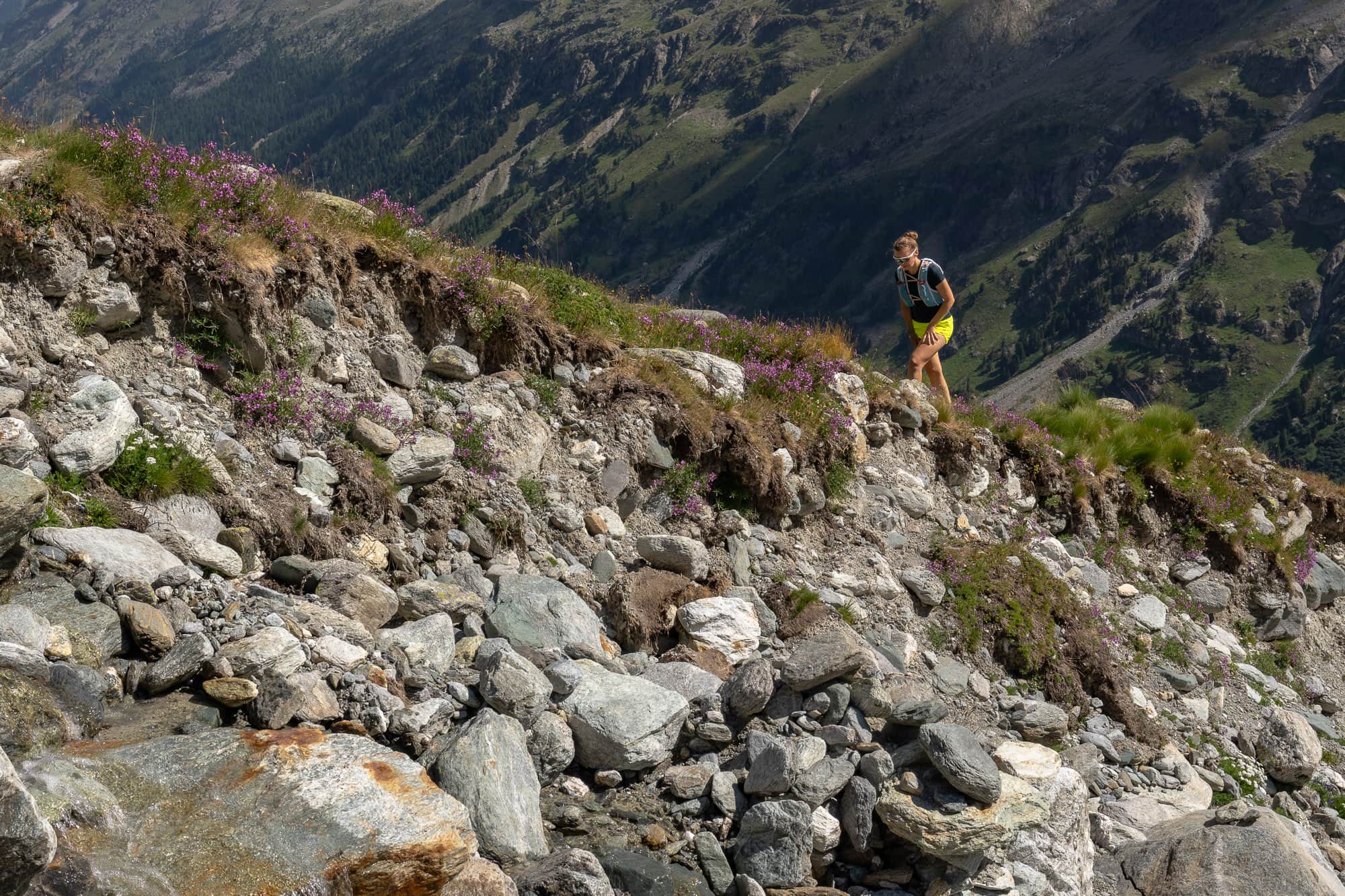
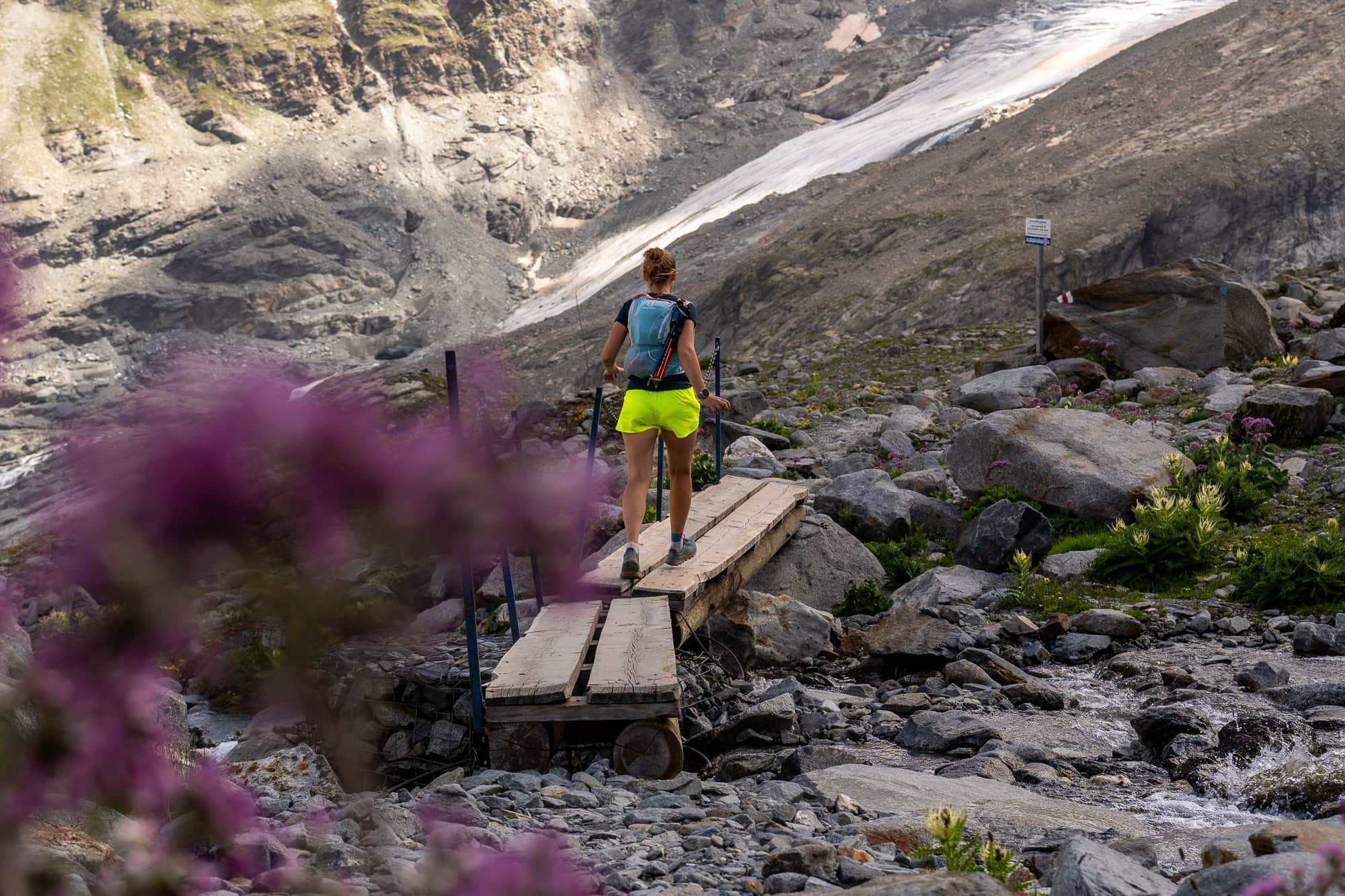
Shaking our heads, we set off again after a short drink break. From Fuorcla Surlej, the rest of our run leads us down a gentle slope along the eastern flank of Val Roseg. A flowing trail awaits us, perfect for running, with perfect views, perfect weather and not-so-perfect legs. The short, steep climbs at the one or other stream crossing are nasty - why exactly is the bridge around 20 - 30 meters further up and not here with us? We don't know, but it hurts for a short while.
After crossing the wooden bridge, the main ascent of today's run awaits us. Whereby main ascent is a big word for a relatively small amount of altitude. We only have to climb about 100 meters, spread over a handful of kilometers, to pass the highest point of the hut trail to Chamanna Coaz at about 2,670 meters. The brilliant view makes up for the effort, as the end of the Val Roseg valley has now also moved into our field of vision and with it Il Chapütschin, Piz Glüschaint, La Sella, Dschimels and Piz Sella right next to the Fuorcla da la Sella of the same name. In mid-August, the snow line had already shifted very far upwards and the Sahara dust underneath was starting to reappear.
Visit to the Coaz hut - it's tea time
The surroundings become rougher, the vegetation more colorful: we approach the cozy Chamanna Coaz, which nestles on a rock platform at 2,611 m below the rugged Vadret da Roseg. Around 200 meters before the hut, we cross another belt of purple alpine flowers - a sight you wouldn't expect to see here.
As is tradition, we pour ourselves a liter of well-sweetened tea on the hut's panoramic terrace - there is hardly anything more refreshing during a trail run and this type of hydration is also well tolerated. We prefer to decline the offer of the hut cake, even though it would undoubtedly taste delicious. But there are still 13 kilometers to go and we want to tackle them on a light stomach.
The Coazhütte was renovated just a few years ago and now presents itself from a decidedly inviting side. The almost circular shape seen from a bird's eye view and the associated unconventional geometry of the bedrooms have been retained, but otherwise almost everything shines like new.
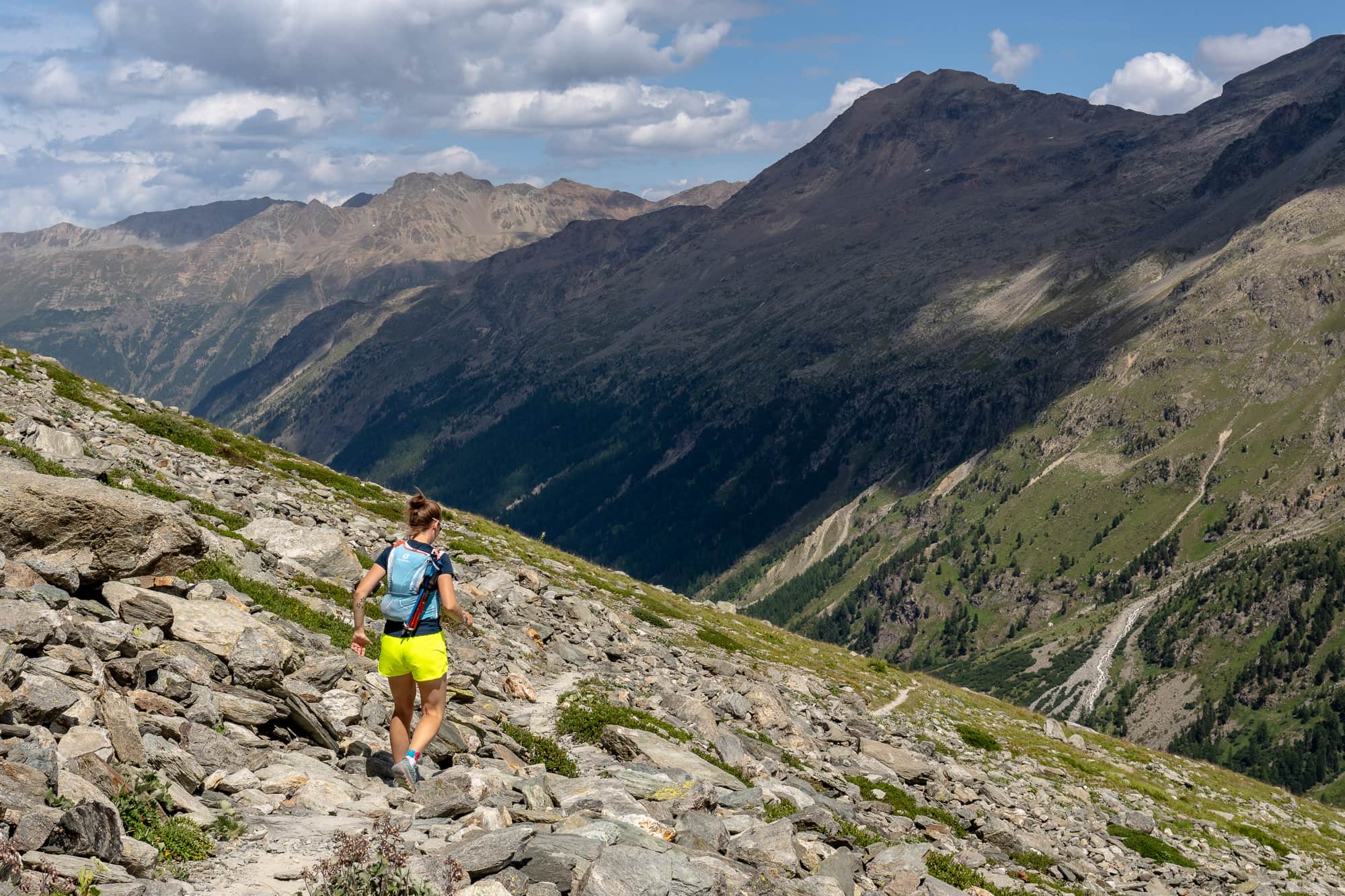
Our legs don't feel quite as new, despite the welcome break on the hut terrace. We set off again in the direction of the somewhat demotivating view out of the valley towards Val Roseg. Very far away, we can make out the location of Pontresina, our destination for this run. But first we have to make our way back to a fork in the path at P. 2521.
Flow trails in Val Roseg
The herbal tea has an effect after all and we can enjoy the flowing trail to the full. The landscape slowly glides past us: Lej da Vadret, Piz Morteratsch and Piz Tschierva come into view, the Chamanna da Tschierva, starting point for the famous Biancograt and dominating everything is the huge cone of rubble below the Vadret da Tschierva. Another nasty counter-climb to a small bridge, then we have reached the junction that we already passed on the way down from Fuorcla Surlej.
We still have 500 meters of ascent down the valley ahead of us, which unfortunately is not quite as relaxed as the previous section. The descent past the abandoned Alp Margun da l'Alp Ota is somewhat overgrown in places and the path is laboriously bumpy. We slow down a little so as not to twist our ankles in this terrain because we can't see the path clearly.
But even this short jungle passage comes to an end and the approaching tinkling of cowbells tells us unmistakably that we are approaching the valley floor. From here, the technical difficulties are over and a wide alpine path, which later turns into a natural road used by horse-drawn carriages from the Hotel Roseg, will accompany us for the last few kilometers out of the valley.
You get used to the skeptical looks from the carriages, but not to the disgusting heat down here. Neither of us are great heat runners and long for the cooler temperatures back at the Coazhütte. But that doesn't help now. If we don't want to sit in the carriage (and that's somehow not an option...) we still have to get through it. But even the last handful of kilometers are coming to an end and at Pontresina station we both press the stop buttons on our watches and finish another wonderful run through the entire Val Roseg, from high alpine surroundings down to the larch forests around Pontresina.
And as is always the case, we are faced with an unpleasant final sprint shortly afterwards, as the departure time of the bus back to our van at Camping Morteratsch unfortunately doesn't correlate at all with our arrival time in Pontresina. So if we don't want to spend a long time waiting around stupidly at a bus stop (we don't), we have to reach the bus stop with a final sprint uphill, which fortunately we manage to do. What a difference a relaxing shower can make...