"How did I get myself into this situation?" it shoots through my head. I'm hot and cold at the same time and I don't dare go forwards or backwards. My breathing is rapid and my knees are weak as I sit on the narrow ledge that is (or should be) the hiking trail. I try to calm myself down, make sure I'm stable and concentrate on the small patch of earth in front of me. Prickly blades of grass and low herbs grow on the steep flank. Gray rock is covered with loose dark brown soil. I inhale deeply and exhale very slowly and my pulse calms down noticeably. My fear of heights is kicking in again today - and it's annoying! Because I don't want to sit here and be scared, I want to go for a cool trail run. But where am I actually here?
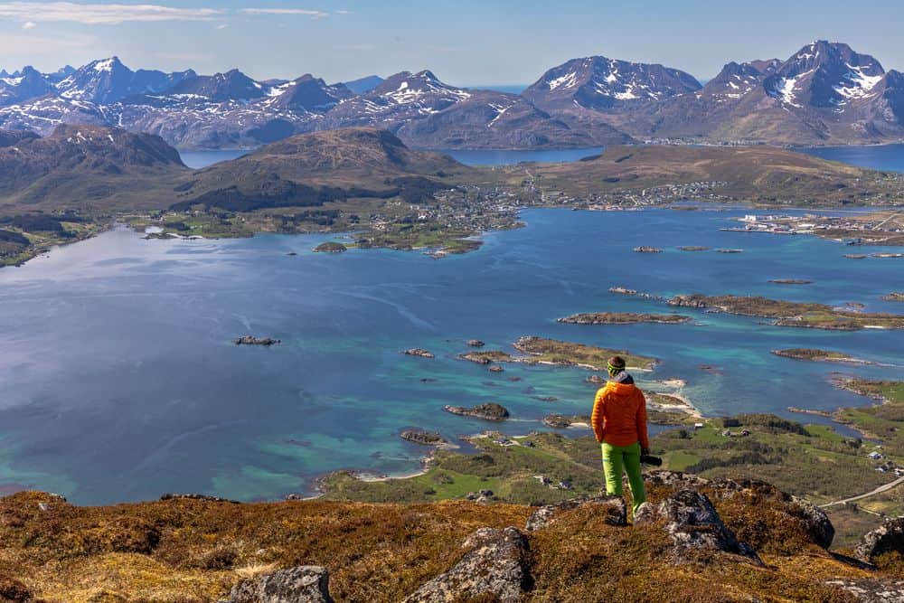
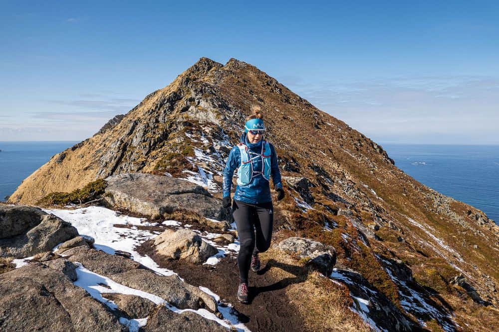
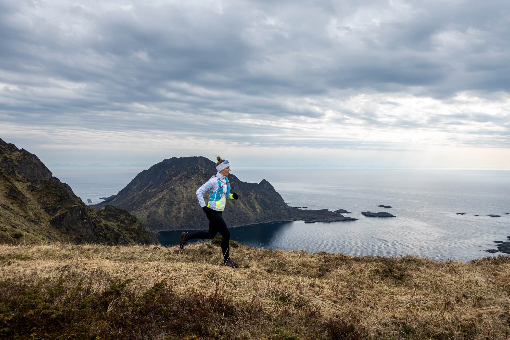
The day actually started quite well here in Lofoten and after a hearty breakfast with plenty of Freia chocolate cream, we set off. Our route starts in Mortsund, right by the Lofoten Seafood Center. The narrow hiking trail on the opposite side of the road is barely visible and not marked. But since there is no other, we are pretty sure we are in the right place. With the sun behind us, we set off, skipping from one stone to another over the muddy puddles - a typical Norwegian coastal path. After the first few hundred meters of elevation gain, the path quickly becomes steeper and the jogging turns into brisk walking. However, we were expecting this, as the few descriptions of this tour that could be found online were quite clear: it's steep here. Unlike running, where I have to concentrate mainly on the path, walking leaves more time to look around and marvel, and the landscape in which we find ourselves literally invites you to do so. The many red rorbuer huddled against the coast below us look like pearls strung on a string and the typical bright Falun red of the wooden facades contrasts sharply with the blue water and the green-brown grass mats of the surrounding mountains.
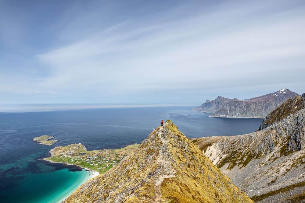
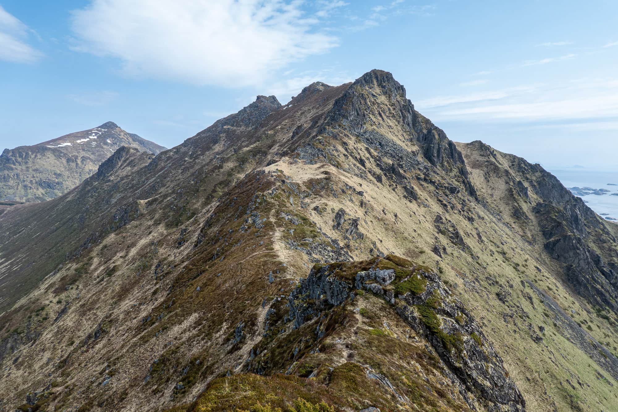
As we continue, rugged passages alternate with short "joggable" sections and soon we are standing on the summit of the 300-metre-high Middagstinden. The Atlantic Ocean stretches out below us and we enjoy the wonderful panoramic view. The sun is now hiding behind a thick blanket of cloud and the wind has picked up considerably. We don't want to lose any time on the exposed summit, as our sweaty bodies cool down quickly. We quickly descend a few meters to get back on the path, which we continue to follow. Always along the narrow ridge.
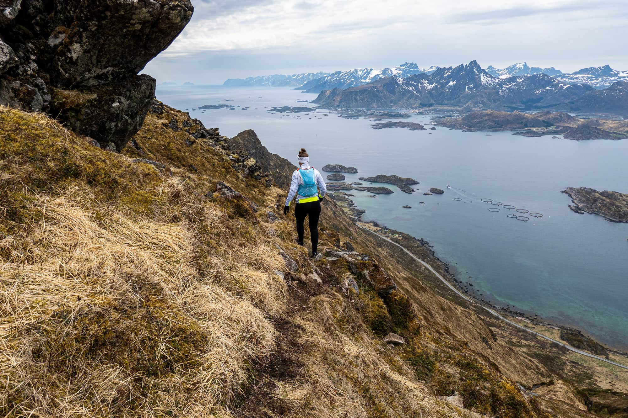
The terrain becomes more difficult, the crossings through the steep terrain are on extremely narrow trails, some of which are crumbly or broken and the steep ascents allow me to take a firm grip. At one point, however, my fear of heights makes itself heard and forces me to stop. "You must be crazy, can't you see how steep it is?" the caution-loving voice in my head warns me. "Yes, of course I can see, but I can also see the path," counters my thirst for adventure. "And there's Falko, walking on without a problem. And there's a hiker on the way too, right up there. It can't be that difficult." This, or something similar, is how these situations play out in my head. When fear wins out, I turn back in places like this and retreat. But not today. Falko offers that I can wait here, or a little further down, while he continues walking, but I know that he would actually like me to join him. He wants to continue walking with me. I take a few minutes and after I'm breathing more calmly again and the situation seems less threatening, I get up very slowly and continue walking. My fear of heights is still present, but for now it keeps quiet. Step by step, I regain my courage. Today I am stronger than my fear and a little proud of myself.
However, we don't quite make it to the summit of Breitinden. Shortly before Kamman, on an unnamed peak around 470 meters high, we decide to skip our destination, the summit of Breitinden. Despite our efforts, the wind cools us down faster than we would like and as soon as we stop for even a minute, we immediately get bitterly cold despite our warm and windproof running jackets. We decide to retreat before we are completely frozen through, because after all, I have to get everything I've scrambled up to here back down again somehow. The thought is already making me weak at the knees, but it doesn't help. So I pluck up my courage, turn around and off I go towards Mortsund and the coast.
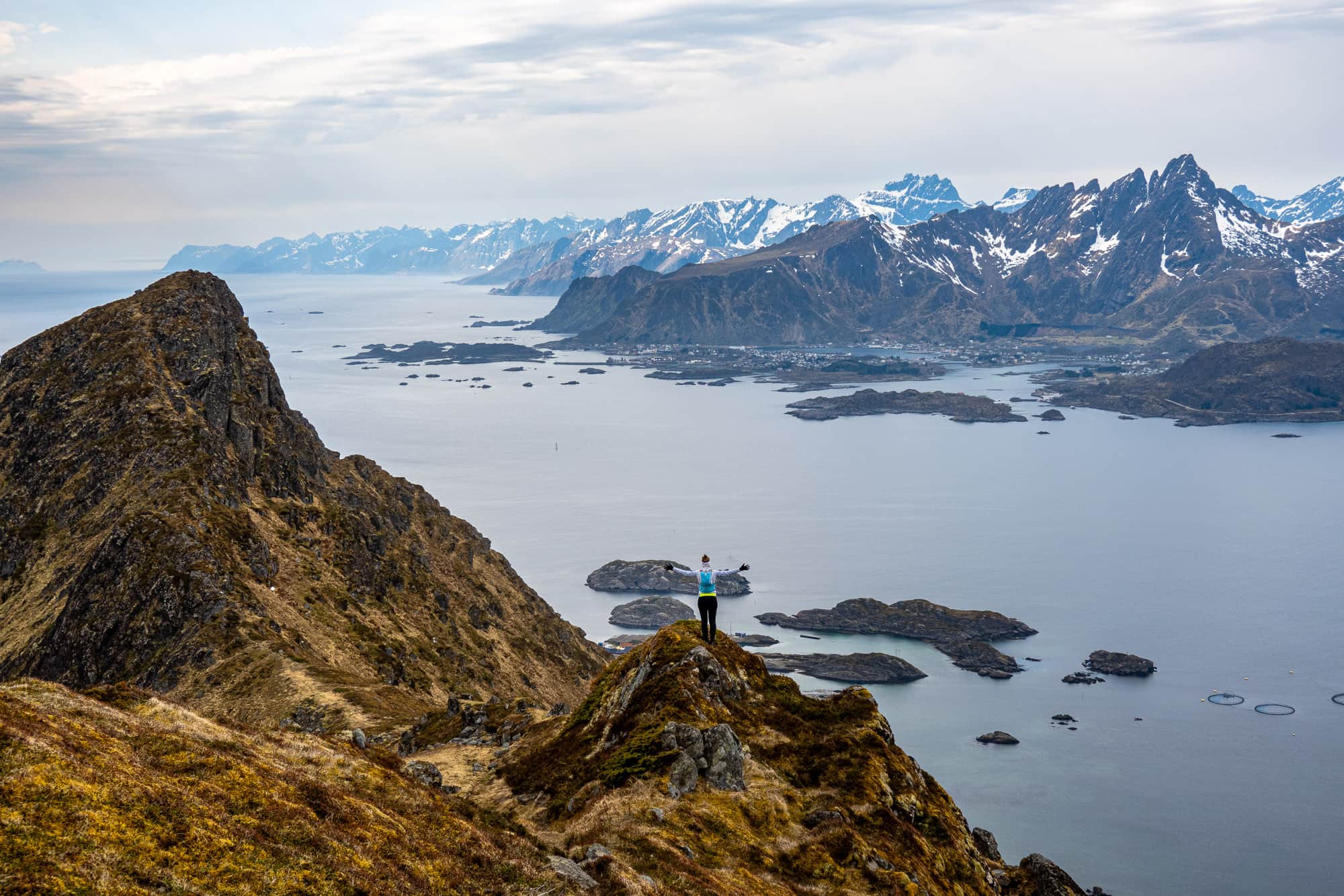
Surprisingly, the descent goes better than I would have expected and the exposed cross passages are (at least a little) easier for me than on the ascent. My confidence returns and when we reach the summit of Middagstinden again after a few tricky sections, the tension finally falls away from me. I turn on my own axis once more and mentally soak up this incredible 360° panorama. The loose cloud cover that lets the occasional ray of sunshine shine down onto the sea, the small and larger islands that rise out of the Atlantic in front of us, the barely recognizable peaks over on the mainland and in the immediate vicinity below us Leknes and Gravdal and below the summit of Nonstinden, Ballstad nestles against the coast. But now let's move on quickly before we get even colder and our muscles get stiff.
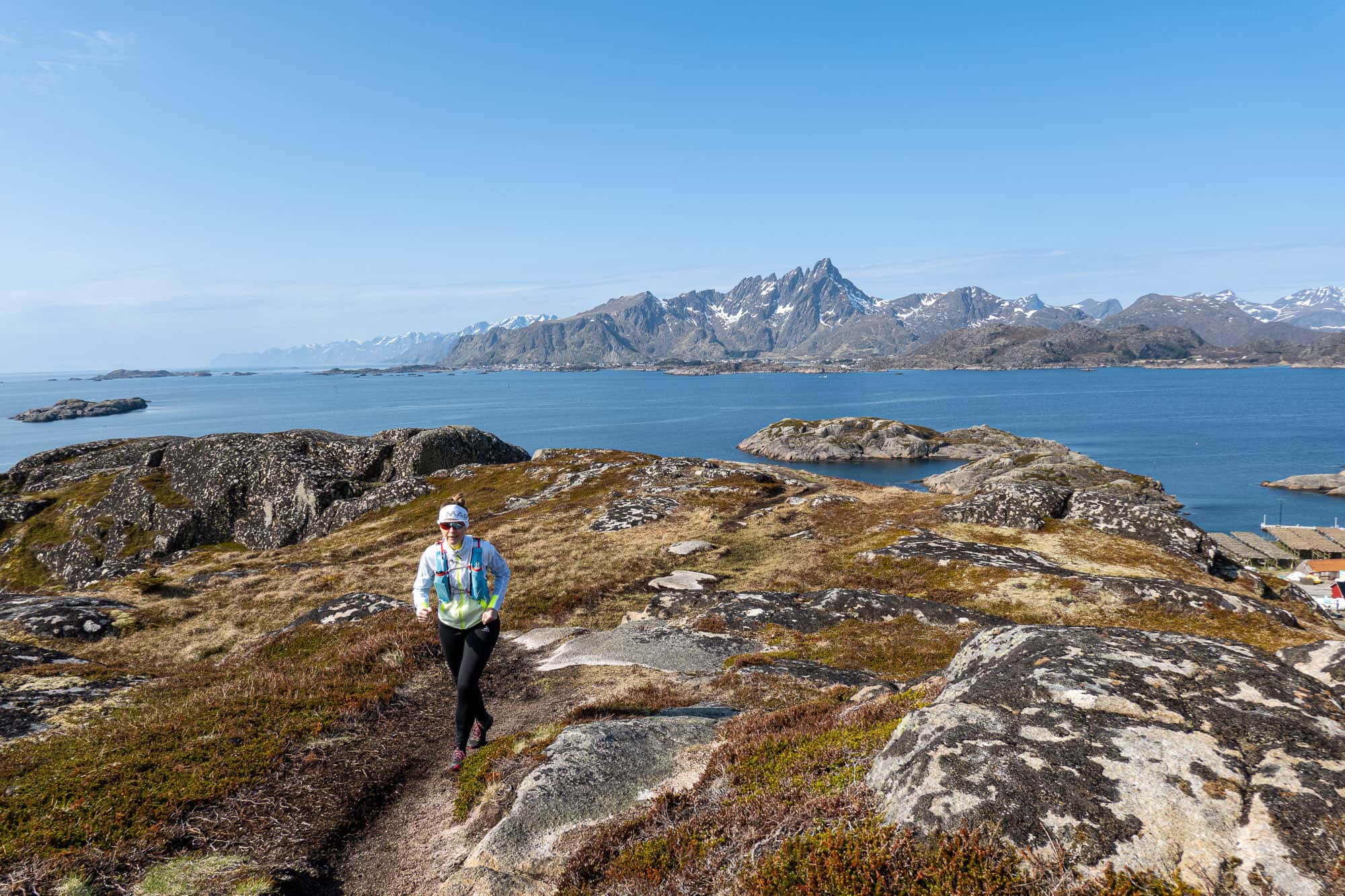
Frozen and looking forward to a hot shower, we reach the parking lot at the Seafood Center, our starting point, a short time later. Even though we didn't reach the actual summit this time, I still managed to take an important step - namely one forward to confront my fear of heights instead of immediately turning around and giving in at the first sign of uncertainty. Maybe that's even better than "just" a summit.
I am well aware that there is a point at which you should definitely turn back on a tour and I don't want to give anyone false courage. Everyone has to decide for themselves at any given moment whether it makes sense and is justifiable to continue or whether it would only make the situation worse. I felt so good that day that I was pretty sure I could go on. Listen to your own gut feeling when you're out and about and never let yourself be put under pressure, even in a group, if you don't feel comfortable.