
Tipping points. There are different tipping points in our world, for most of us the term is certainly associated with not very edifying future scenarios in connection with global warming. But there is also a tipping point in running, especially in steep mountain runs (at least that’s how I always refer to this shaky moment): is it still worth jogging, or is all that energy just wasted in a pointless and inefficient attempt to portray an image of a runner, while walking fast would be at least as fast and use even less energy at the same time?
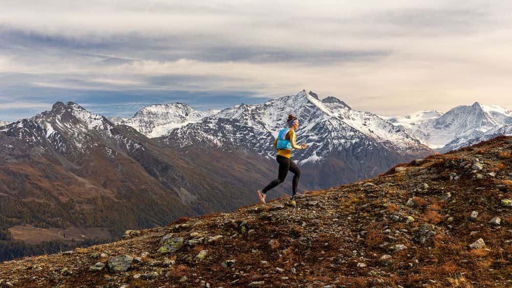
The legs say “Leave it!”, the will says “Go for it!”, only the runner says nothing, because I simply lack the air for profound self-talk right now. I am on the way in the Rhone valley, more precisely on the way up to the small alpine hut Prabé, which lies picturesquely above Sion. The climb up there is quite a beast and could be a good candidate for a so-called vertical kilometer: a route as consistently steep as possible that is still runnable and overcomes 1000 meters of altitude in the shortest possible distance. The marked trail immediately gets serious and simply omits effort-saving switchbacks. Individual high steps over roots or stones do not even allow thoughts of a relaxed run-in and warming up to arise, but it goes straight to the point.
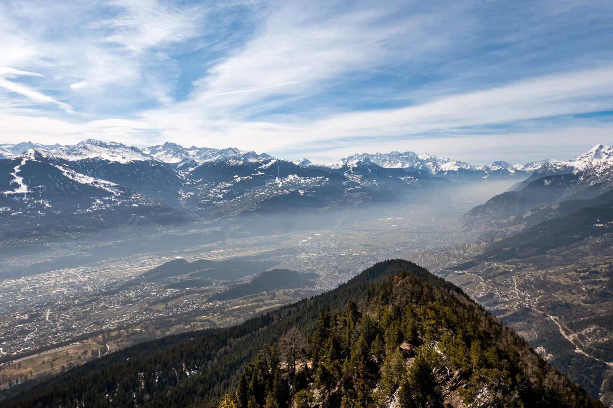
The 2042 m high Prabé is not really a mountain in its own right, but rather a gentle crest in the long ridge that leads up to the 2730 m high Sé Noir. Although one would intuitively count these mountains, located on the north side of the Rhone Valley, as part of the Valais, they already belong to the Bernese Alps. They rise above the Valais municipality of Savièse, just a few kilometers from the fashionable ski resort of Crans Montana. The extension of the ridge above Sé Noir literally culminates in the 3250-meter Wildhorn, the glaciated and highest mountain in this region.
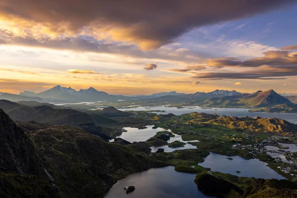
The capital of the Valais, Sion, is about 1500 m lower and dominates this area of the Rhone Valley with its castles and churches, the highway and railroad tracks, and surrounding ski resorts such as Thyon. Opposite Prabé, the Val d’Hérens leads southward into the heart of the Valais mountains and at the end is strikingly overlooked by the highly visible Dent Blanche and other high three-thousand-meter peaks around the mountain village of Arolla.
The gloves are in the meantime already stowed in my small running backpack, the jacket opened a bit and the terrain fools me with supposedly flatter sections that start right up there. If I then reach the said place, it turns out to be only a short pause of a few meters before it gets steeper again. What’s troublesome is that I already know the route and know that it also becomes flatter again. But I don’t know it so well that I know exactly where this is the case. So the only thing I can do is bite through and climb meter after meter on the small, partly narrow and exposed mountain path.
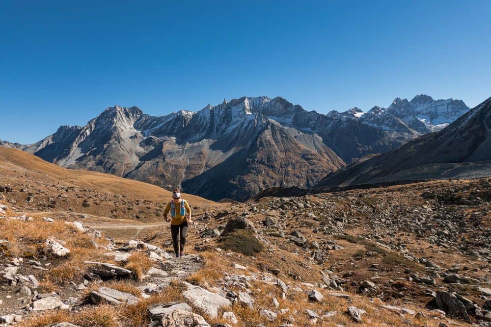
The hiking trail up to Prabé is quite popular, as it always offers beautiful views of the vastness of the Rhone Valley and the 4000-meter peaks of the Valais on the opposite side of the valley. It seems like the miniature wonderland in real and just invites to discover the details and to puzzle a little about the names of all these mountains that line up in all their splendor before the eye of the beholder. Gray ribbons of road cross forests, traverse mountain slopes and connect villages. The Rhone flows unmoved by all this bustle in the valley toward Lake Geneva, dragging the highway and rail line toward Montreux alongside it.
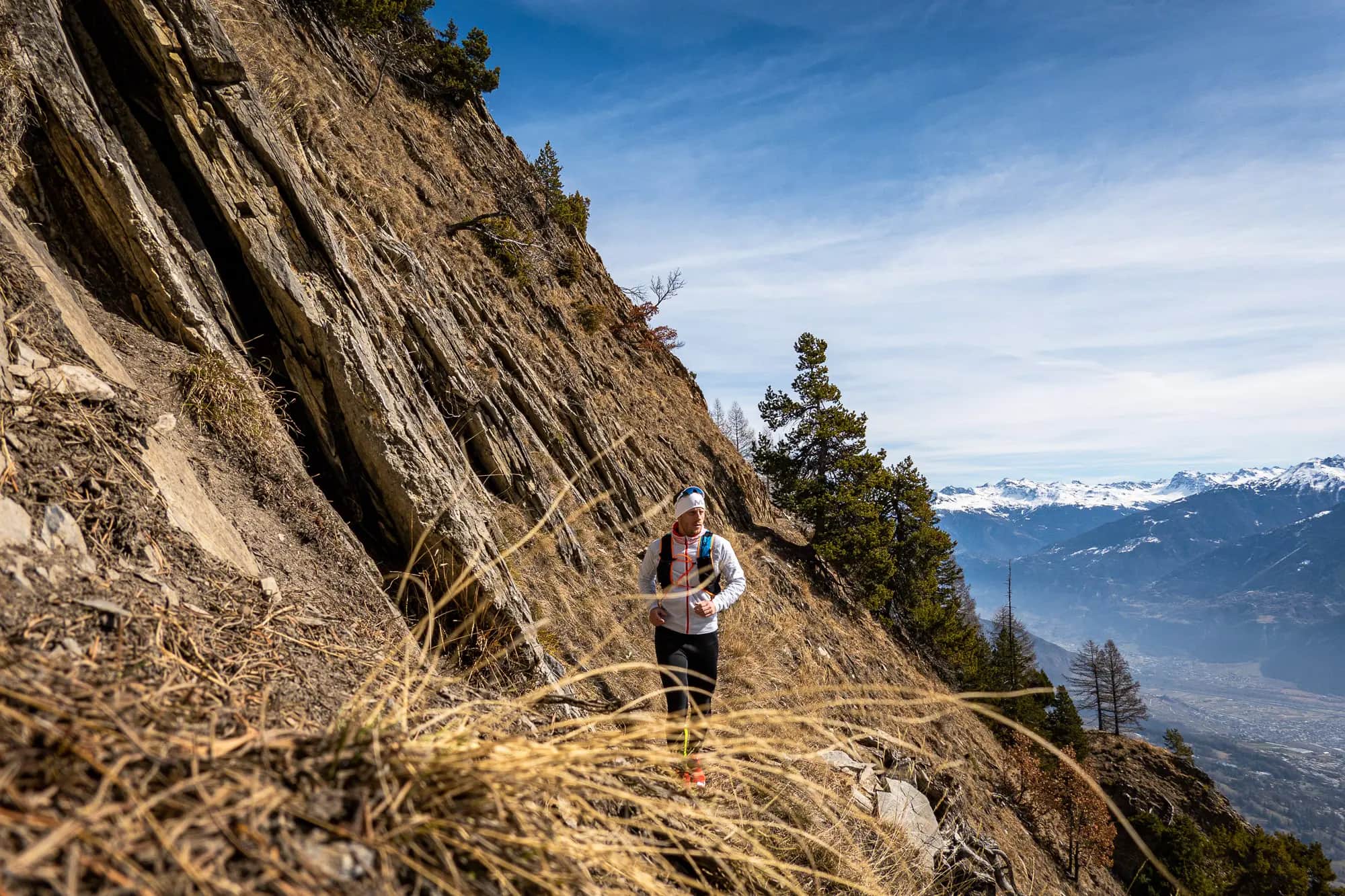
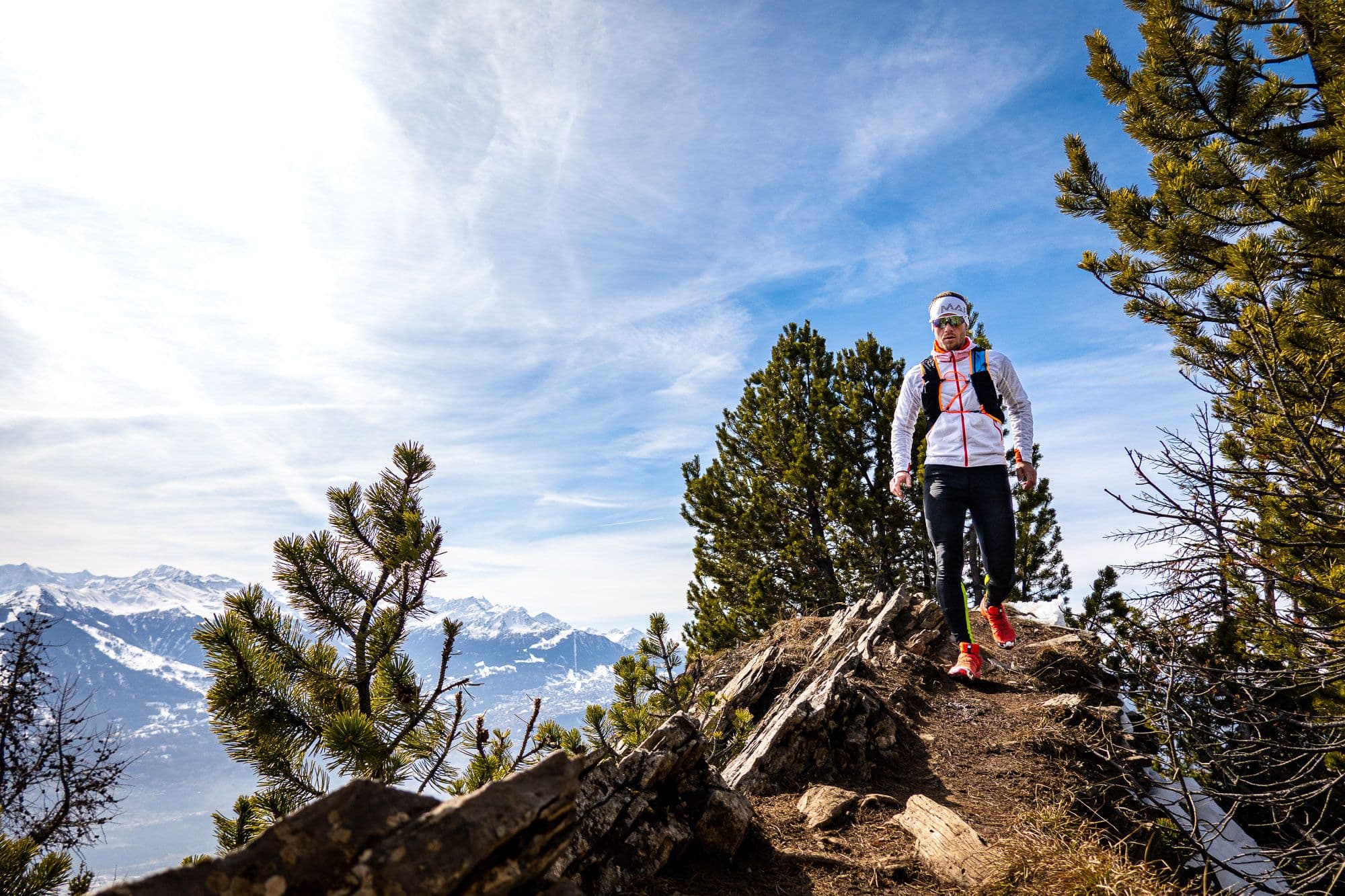
From the right, the driveway joins the hiking trail that leads up from Mayens de la Zour. From here begins the most scenic part of the climb, which leads me out of the forest after a few more steep meters of altitude along an exposed rocky flank. Steep slabs lead into the depths, the path is only a narrow path carved into the rock, no one should miss here. The path is “only” marked in red and white, but every hiker or runner should have a head for heights and be sure-footed so that the tour does not become an ordeal.
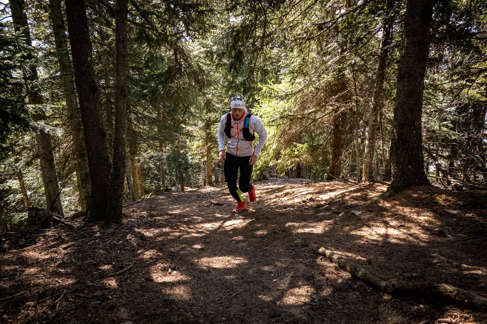
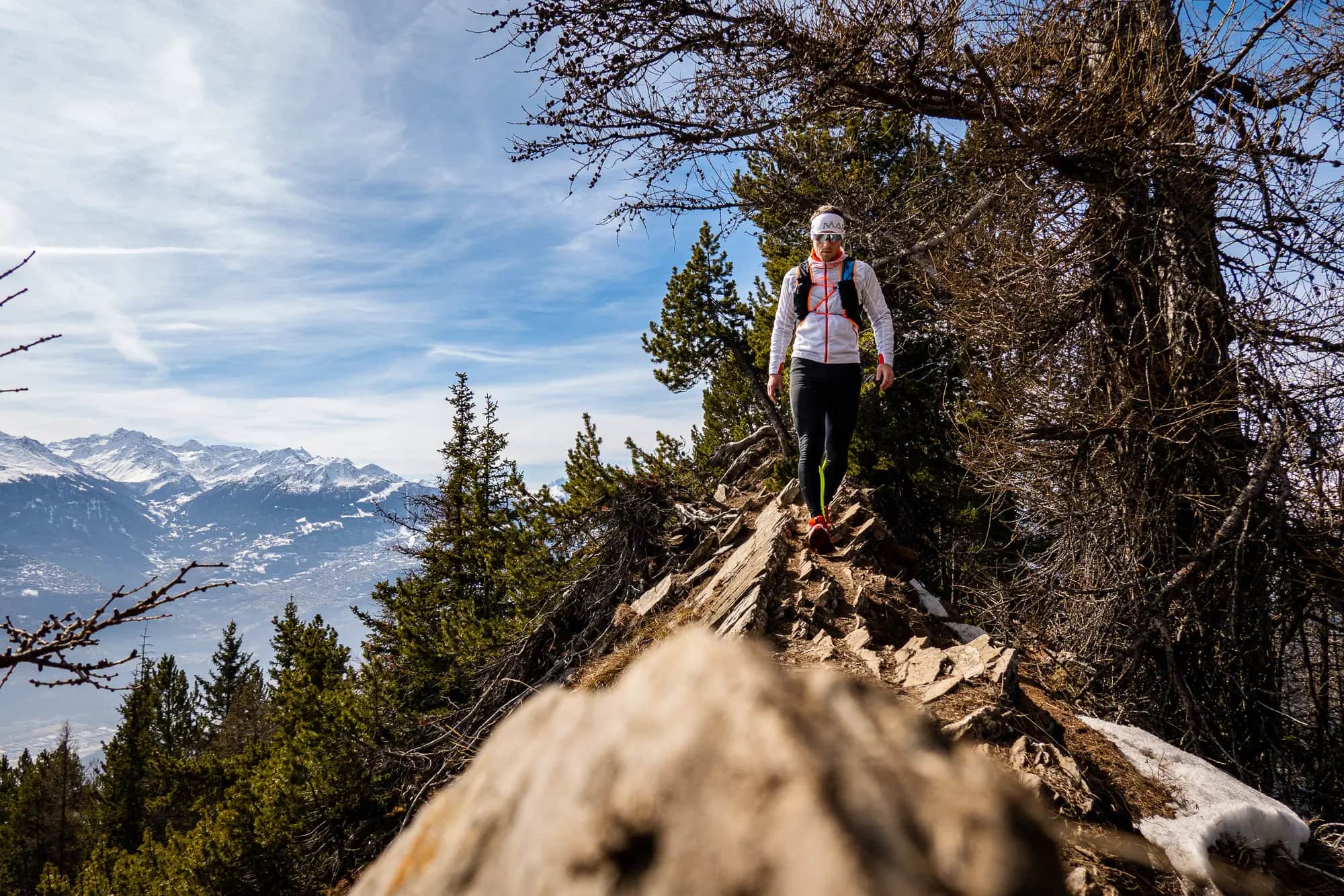
Individual larches, which have shed all their needles at the moment, line the path, which zigzags further upwards. In autumn, especially this part of the path with the shining larches is a beautiful section, now in spring, however, a rather dreary gray dominates the vegetation.
I am greeted, but not by other runners or hikers, but by some chamois that eye my panting skeptically (or mockingly?). Where we humans usually fancy where we can get in the alpine terrain how fast and supposedly elegantly, the chamois has already been there and just asks “Was what?”. Not to mention the speed with which almost vertical rock slabs and rugged, exposed terrain are mastered.
It is now also exposed for me. First the path leads over a short, exposed and rooted ridge, then westward and somewhat shaded around a few last patches of snow to a gentle knoll covered by a currently yellow grassland. Flat, sunny, partly a sparse stand of trees: ideal running terrain and a reward after the steep sections in the lower part of this mountain run. After the small Cabane de Prabé, it’s only a short distance to my destination today, a small knoll just below Prabé. However, there is still snow here and with the running shoes it makes little sense to wade through there.
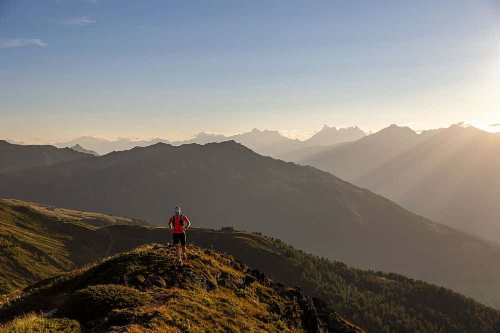
Soak up the sun, catch your breath and enjoy the view. That’s what pretty much everyone does up here. There are plenty of idyllic spots and isolated seating areas, and if you want, you can even spend the night in the unattended Cabane de Prabé (in summer, however, there may be no water). As a mountain run and hike, the Prabé is a beautiful destination, depending on the starting point you have to plan at least 800 meters of altitude. Ideal start are the parking lots at the starting point to the Ancien Bisse de Savièse. The time required varies greatly, of course, depending on the running or walking pace, for runners one to one and a half hours for the ascent are certainly feasible.
The way back is easy in terms of route finding, because it goes back the same way. In places you should be careful, even and especially as a runner, because some passages can be quite muddy and some exposed places leave no room for over-motivated missteps. The chamois show me once again how real professionals move in pathless terrain with breathtaking speed. All that remains for me is the human trudge along a marked trail and the realization that even the best training and the most expensive equipment can’t enable anyone to perform like these animals, who have their habitat here.
The trail run up the Prabé is certainly not one of the insider tips in the Sion region, but it is still worth a visit at any time. Those who like steep, alpine runs will get their money’s worth here, including impressive low views and a breathtaking view of the 4000-meter peaks of the Valais. The individual route can be extended or lengthened as desired – there are hardly any limits to the imagination in the dense network of trails on the northern side of the Rhone Valley.