Alpine hike to the Pizzo Cassinello.

Route information is available for this story:

Alpine hike on the Pizzo Cassinello – 3102 m

T3+ (E2)
StoriesJune 2022

Sugared, peppered and salty - a menu à la Pizzo Cassinello. We really enjoy the hike up the 3000-metre peak in the Adula Group.

Mountaineering is like cooking – a professional menu does not create itself. To put a culinary feast on the table or a successful tour under the hat, you need broad know-how, some practice and a lot of experience. On some days it tastes good, on others not so much. It often depends on whether we combine the ingredients correctly, assess the difficulties correctly and the conditions are right. Although the ascent to the 3103 m high Pizzo Cassinello felt quite salty to me, it was then the truest pleasure in the descent and in the departure an endless Hatsch. A menu à la Cassinello.

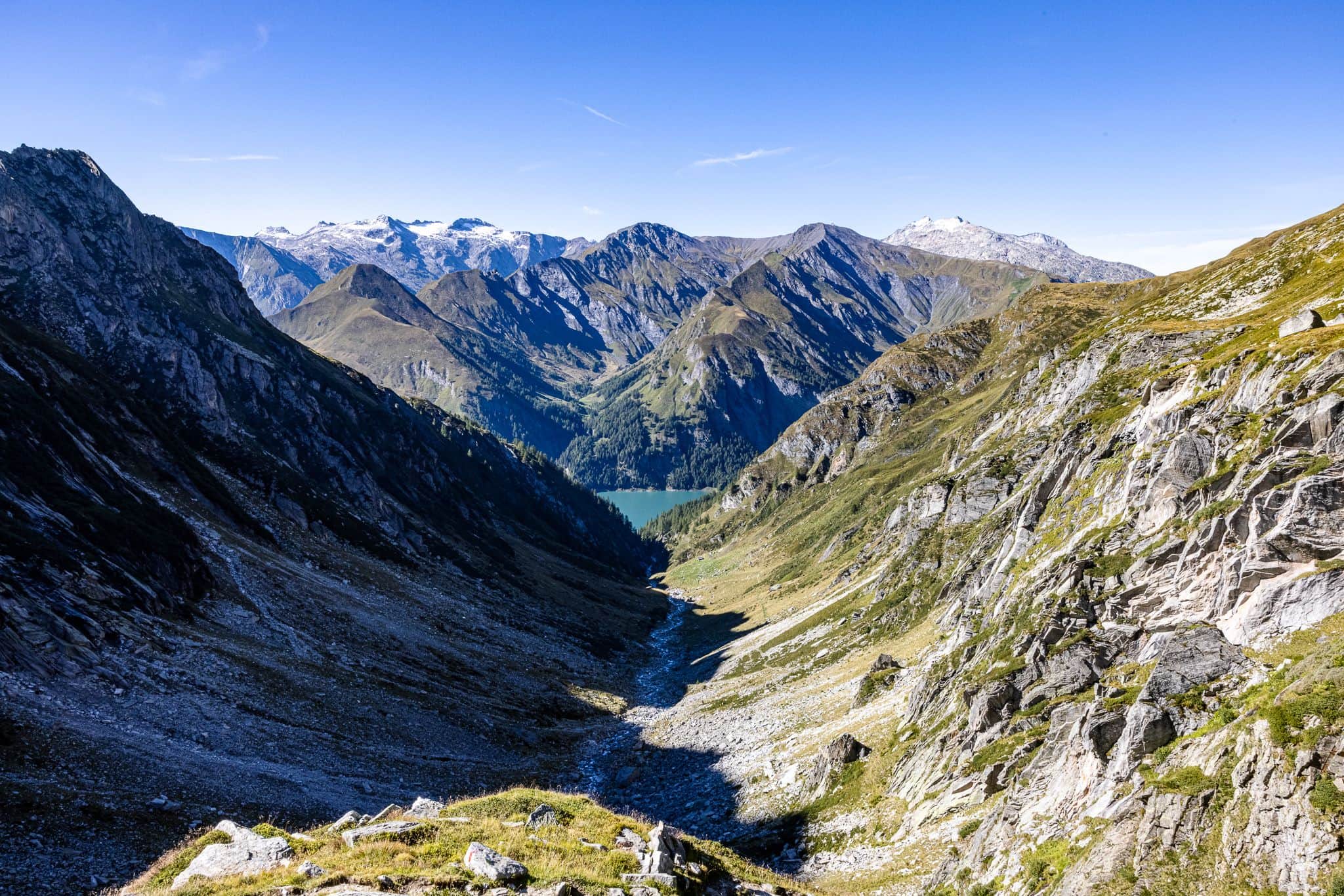
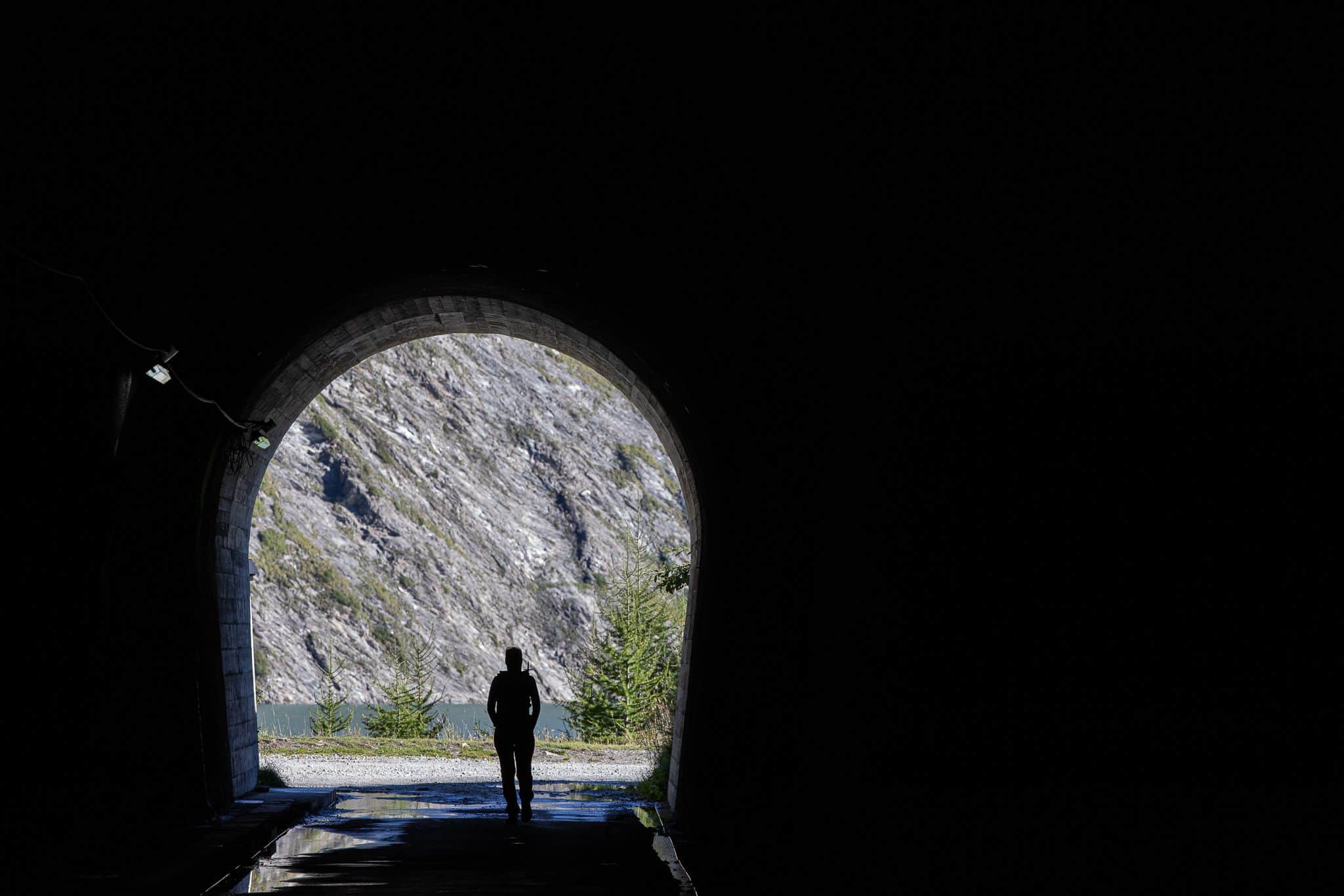
To start our tour on the Pizzo Cassinello, we are served an 800 m long and ice-cold tunnel as a greeting from the kitchen, so to speak. After only a few minutes of morning sun, we dive into the black hole on the opposite side of the dam on Lago di Luzzone. We disappear in the darkness and our hands deep in our pockets.

Tunnel views at Lago di Luzzone

In the climb to Passo di Soreda, where we will later branch off to the summit, we come across the Alpe Scaradra di Sotto, already abandoned at this time of year. The fountain tempts me to fill up my water reserves. However, this soup is oversalted: when I check the quality of the water in my bottle, my eyes get stuck on many small black particles that certainly don’t belong there. There the cook has slipped probably the spice can and I am my water reserves for the remaining tour loose. Maybe we will find a clean spring water bar further up, where we can supply ourselves.

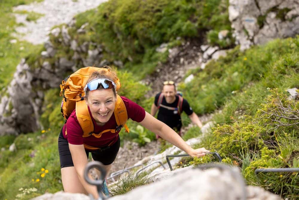
Peppered is then also the couloir up to the Passo di Soreda. Actually, I already know this section of the trail, because in 2014 we were already here on a two-day bivouac tour. But sometimes it just does not taste and today the high steps and the crumbly rocky steps and iron steps are a bit too sharp for me. With unsteady footing and like an awkward gingerbread man, I make only slow progress. In a proper menu, fish is usually the third course. But I definitely don’t feel like a fish in water here. Rather like one on dry land.

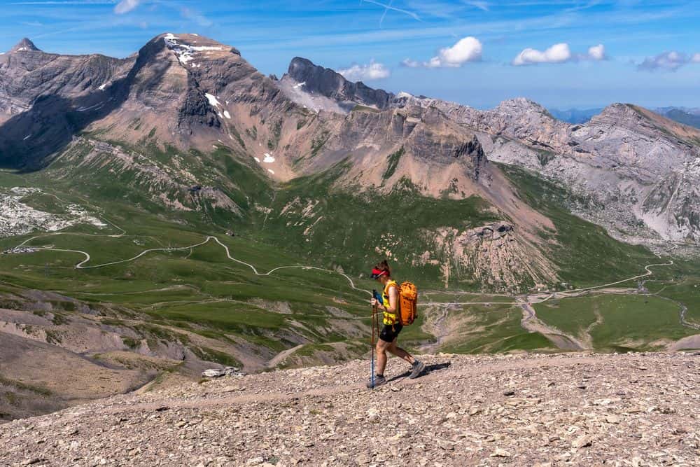
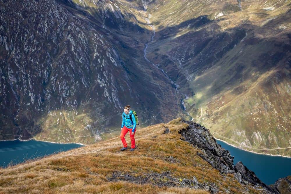
At Passo di Soreda I can digest briefly before continuing with the main course. The blue-white marked path over mostly flat terrain to Pizzo Cassinello is slightly sugared by the last cold front. The snow fields make the mountain shine as if glazed with icing. The individual boulders look like sprinkles from the white mass.

Ascent to the Pizzo Cassinello

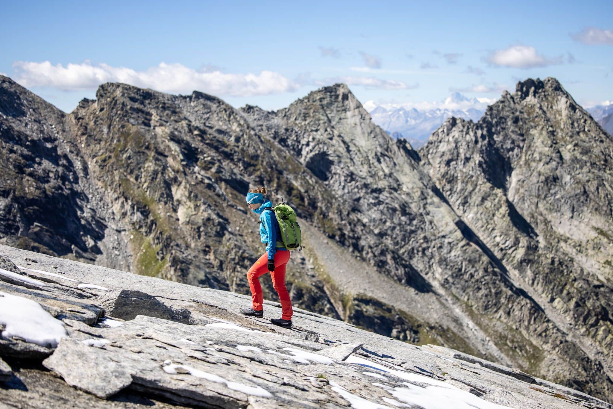
Slab terrain and snow? I’m not so sure that’s to my liking. But to just turn back now without having tackled the summit? That would leave me with a hole in my stomach, I can literally smell the summit roast already. So we climb Zuckerberg and lo and behold, the snow holds on the huge granite slabs better than expected and we feel stuck in the tough sugar mass. A few larger crevasses between the boulders are quickly overcome and thanks to the tracks of other hikers who were on the road a little earlier than us, the ascent is served to us on a silver platter, so to speak.

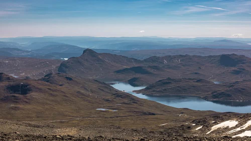
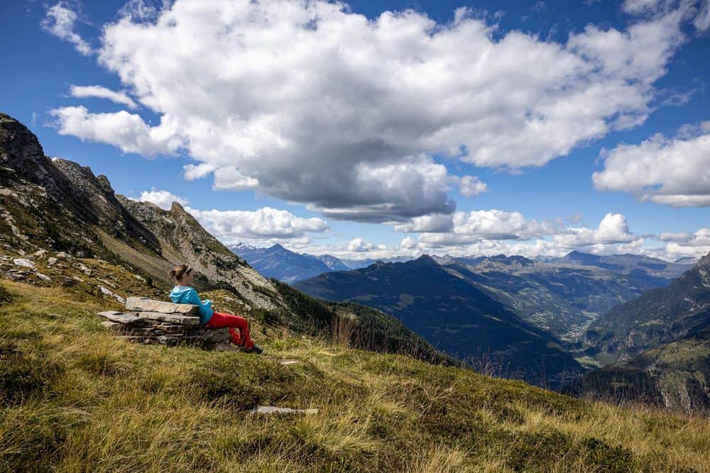
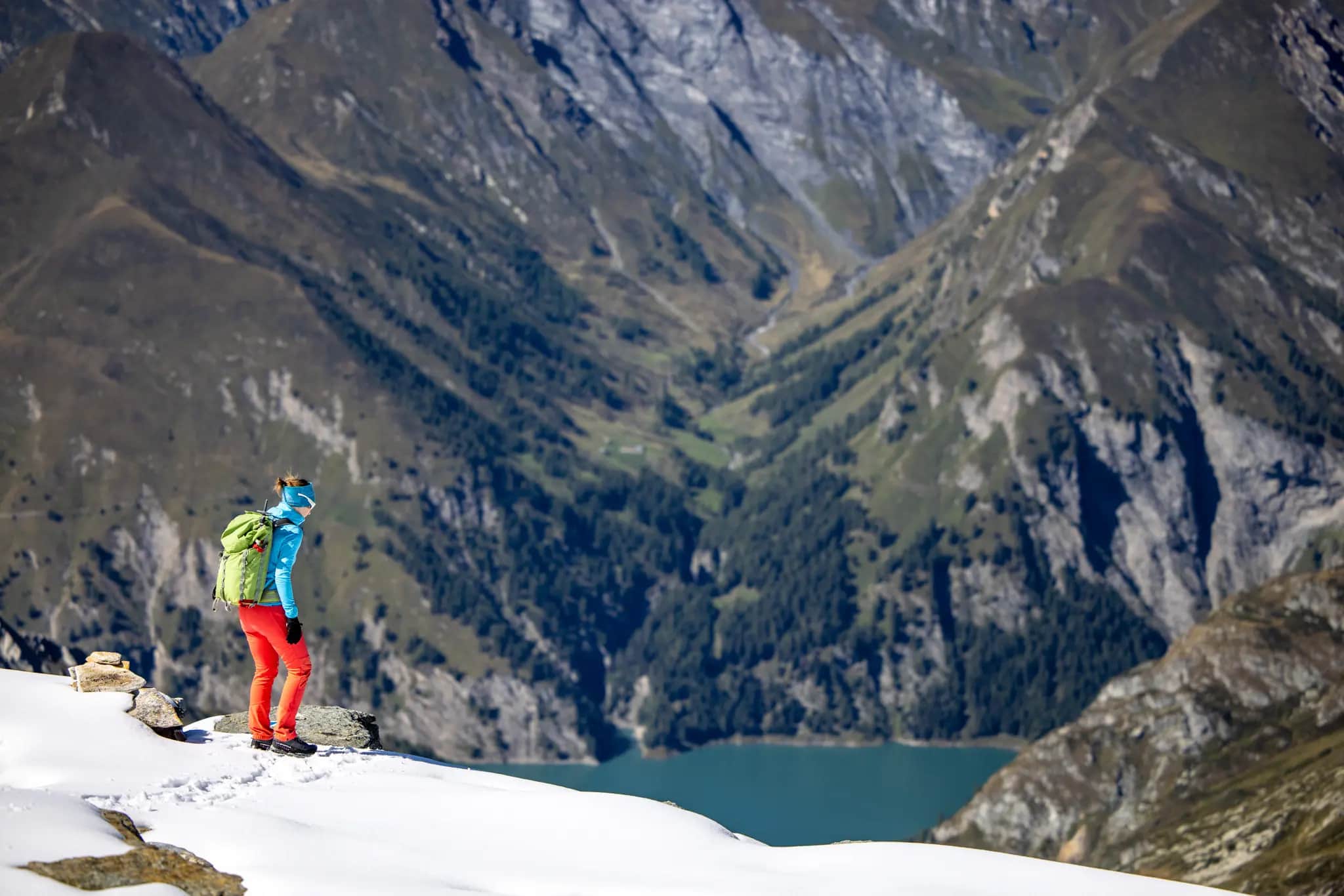
The highest point of Pizzo Cassinello is marked with a plaque and three cairns and is therefore hard to miss. Up here, a true (palate) delight awaits us. The 360° panorama makes us melt away and we can’t get enough of the view of the surrounding mountains. From Lago di Luzzone over the Zervreilahorn to the Rheinwaldhorn we enjoy the full load of deluxe panorama. We say: Delicious!

Ready to jump: deep below lies the Lago di Luzzone

At some point, however, we get tired of it and start the way back. We quickly leave the sugar slabs, which become more slippery in the afternoon sun, behind us. But there is still the steep descent from Passo di Soreda down into Val Scaradra. The thought of it doesn’t exactly make my mouth water. A bit nervous, I poke around with my stick at the first steps, try one or two steep steps and suddenly realize: not so bad. Carefully I meander down the path and with every meter of altitude we lose, my surefootedness grows. After a few steps I can even enjoy the descent more and more. Amazed at how the same section of the path can have such a different effect on me within a few hours, we also take the remaining 1000 meters of altitude under our feet. Only a stop at the mountain water bar, a spring that springs directly from the rock, can hold us for a short while. Cheers!

In the end, only our dessert is bitter. Because instead of a varied cheese platter, we get rather flat feet on the last kilometers of forest road until we arrive back at our starting point from the morning. As tired and satisfied as after a multi-course meal. But with the difference that now our stomachs are really rumbling. Instead of a nightcap in the restaurant, it’s off home to a delicious dinner – probably with only one course 😉.

Typical Ticino high valley in the early evening sun

Information about the route

Alpine hike on the Pizzo Cassinello – 3102 m
T3+ (E2)

Long climb to a high peak in Ticino with an impressive finale on smooth rock slabs.

Facts & figures

Grade

Seriousness

Marking

Total time

Ascent

Descent

Highest point

3'102 m

Distance

19 km

Region

SwitzerlandTicino

Activity type

Route description

We start our ascent of Pizzo Cassinello at the parking lot of the Lago di Luzzone dam. From here, we have around 1,500 meters of ascent ahead of us in a wide variety of terrain. At the start, we follow the road running south of the lake through a long tunnel (headlamp helpful, but it is also possible without one) and along the shore of the reservoir to the mouth of the Val Scaradras. After crossing the Ri di Scaradras on a bridge, we keep to the hiking trail that turns off to the right here with the destination Passo di Soreda.

After just under a kilometer, the typical Ticino vegetation of alder bushes comes to an end and we reach the small Alpe Scaradra di Sotto, an unmanaged hut that is only visited by a few cows or sheep. Be careful at the spring there: we didn't get the impression that you should drink this water.

After the alp, the route climbs steadily up to P. 2182, where we pass within sight of the Rifugio Scaradra. This hut, situated on a rocky ledge, is manned in the summer months and can be used as a base for tours around Pizzo Cassinello. We continue between sheep and reach the screey 600-metre ascent to the Passo di Soreda (2,759 m). Partly secured with chains or short ladders and footbridges, this section leads us upwards until we reach the pass and have our first glimpse of the Länta.

If you were to descend the other side of the pass, you would reach the Zervreila reservoir. However, we turn right here onto the white-blue-white marked hiking trail in the direction of Pizzo Cassinello (marked and signposted). We ascend along the ridge towards the flat summit massif and soon leave the ridge to follow the cairns on the impressive rock formation that lead us up to the summit.

From the summit there is the option of continuing the descent on the opposite side via Piz Cassimoi and then descending either to the Läntahütte or in the direction of Ticino into Val Carassin.

We use the same route for the descent and descend via Passo di Soreda, follow Val Scaradra to Lago di Luzzone and thus reach our starting point at the impressive dam wall again.

Difficulty

Long mountain hike in alpine terrain (T3+). A good level of fitness and safe weather conditions are essential for this tour. Some sections before the Passo di Soreda are secured with chains and stirrups. Overall, the conditions there are screey and you should watch out for falling rocks from people ahead.

At the summit of Pizzo Cassinello, snow fields can make the ascent difficult. However, as long as there is good snow, these can be passed without difficulty.

In the Passo di Soreda area, there is a risk of falling along the ridge.

Key passage

Somewhat fragile passage below the Passo di Soreda.

Best season

Due to the high altitude at 3,102 m, there is still snow for quite a long time, especially in the upper part from the Passo di Soreda. Depending on the amount of snow, the risk of avalanches must even be taken into account here. Normally, from the end of July/beginning of August, conditions prevail in which the ascent on foot is feasible and any snowfields can be crossed safely.

Arrival

From Biasca, follow the Valle di Blenio up to Olivone. The road turns left towards the Nufenen Pass. As you leave Olivone, the road branches off to the right up to Blenio. Follow this road and shortly after Blenio (Ghirone) follow the signposted road, which gains height in several hairpin bends and leads up to the Lago di Luzzone dam. Either go below the dam wall or take the middle tunnel to the upper parking lot.

Postbuses also run to Lago di Luzzone.

Starting point

The starting point is the official, paid parking area at the top of the Lago di Luzzone dam. There is also a restaurant here.

View on Google Maps

Good to know

Impressive dam wall of Lago di Luzzone. The dam wall is home to the highest artificial climbing route in the world. For a fee, you can hire the key to access the route and tackle the five pitches to the top of the dam.

Impressive view of the Zervreilahorn, Güferhorn and Rheinwaldhorn, the highest peak in this region at 3,402 m.

Share article

Trail & Chill Newsletter

Receive a relaxed mountain feeling and other exciting news about trail running, hiking and photography straight to your inbox.
You can find our privacy policy here.

About Marina Kraus

Marina Kraus
Marina feels most at home outdoors – one step at a time, up and down, fully in the moment. As a certified hiking guide in training (Swiss Mountain Guide Association), she plans and leads tours for our community, always on the lookout for hidden paths, scenic break spots, and moments that stay with you. She loves being out there with others – whether it's across rocky ridgelines or through deep green forests. And for those who (just yet) couldn’t join, she shares stories from the trail: honest, down-to-earth, and packed with that special beAnywhere feeling.
Read biography