And one last time we have to balance on tiptoe over a passage several metres long made of cow dung, then it's done and we can tackle the rest of the descent from the Tour d'Aï with dry feet. We already had to walk along here on the ascent, but by now the cow poo has at least dried out, which makes things a little more pleasant.
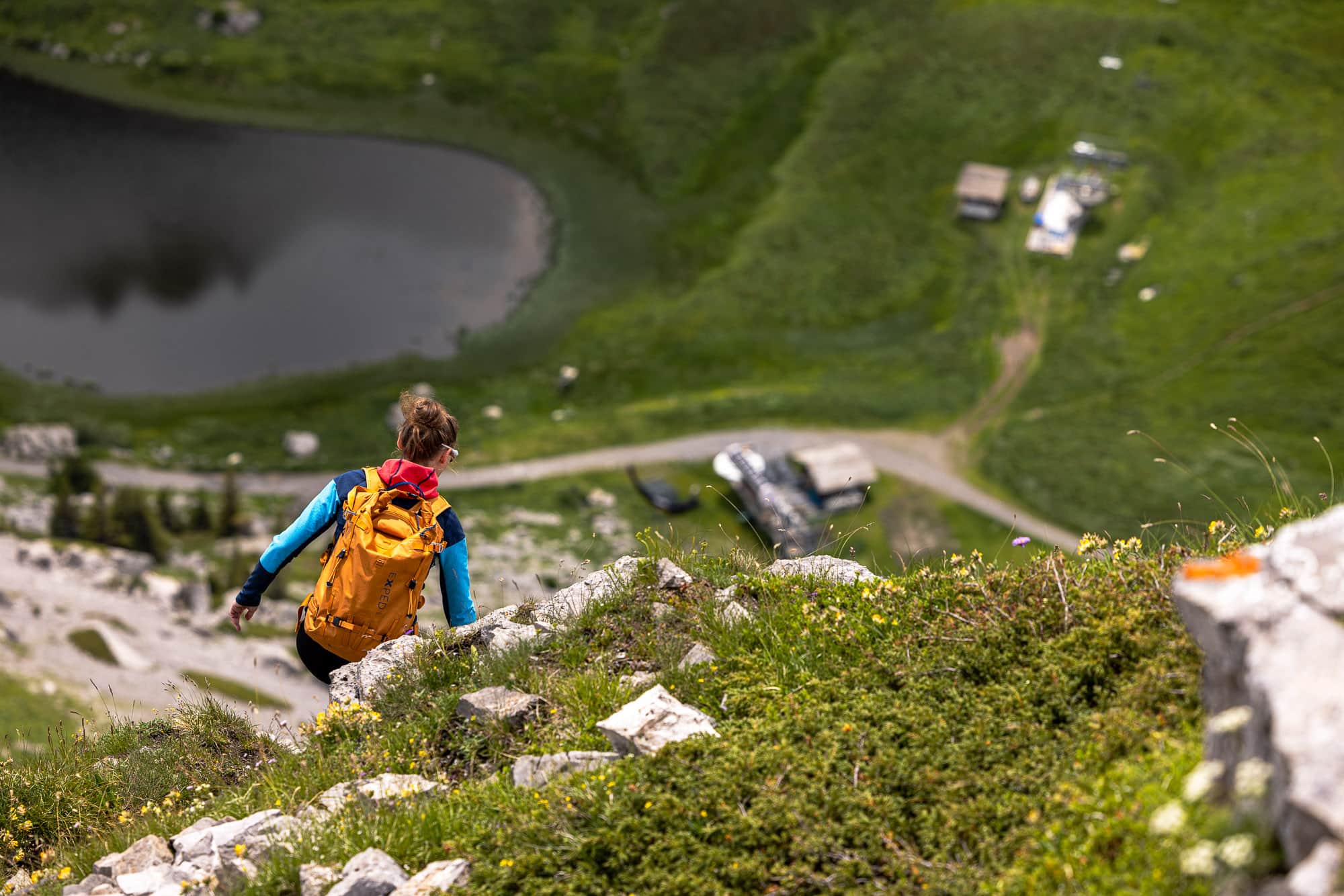
About three hours ago, we started our hike up the Tour d'Aï in Leysin, this unique mountain village high above the Rhone Valley at an altitude of 1,252 metres. The three of us first walked through steep little streets with international schools and colleges, heard a wide variety of languages of all colours on the streets and then turned off to climb up towards the Tour d'Aï. A good 1000 metres in altitude were ahead of us from Leysin, the last 400 of which were exposed on the south-facing normal route, a white-blue-white marked mountain path up to the striking summit of the 2,331 m high Tour d'Aï.
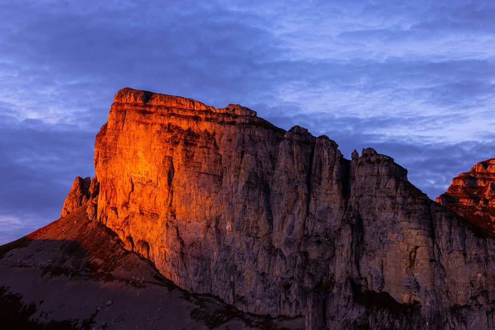
Tour d'Aï, a strange name and a bit of a trick to find this ‘ï’ with its colon on the keyboard. But even in nature, this mountain is not like any other. Its vertical to overhanging west face, traversed by a via ferrata, breaks off impressively into the basin in which the Lac d'Aï stores water for the winter snowmaking of the Leysin ski area. The view from the summit is also impressive, accessible via a long ridge from the south, which today in July resembles a sea of alpine flowers. But we're not there yet, we first have to hike up a few metres in altitude along an asphalted alpine road until we reach the cosy Alp Le Temeley at 1,705 metres. If you like typical Valais dishes, you'll find them here - but it's still too early in the day for us and we quickly leave the alp, the alp road and the tedious alp road behind us as we start to climb northwards through a colourful sea of mountain flowers directly up a steep mountain path towards Lac d'Aï.
It's incredible what grows and thrives at this altitude. As a complete layman with a degree in alpine flora, I don't have much choice but to classify the flowers according to their colours - but still: even without in-depth knowledge, which I have to leave to Marina as a qualified environmental engineer, the sight is beautiful and masks the fact that we are walking around on the ski area's pistes.
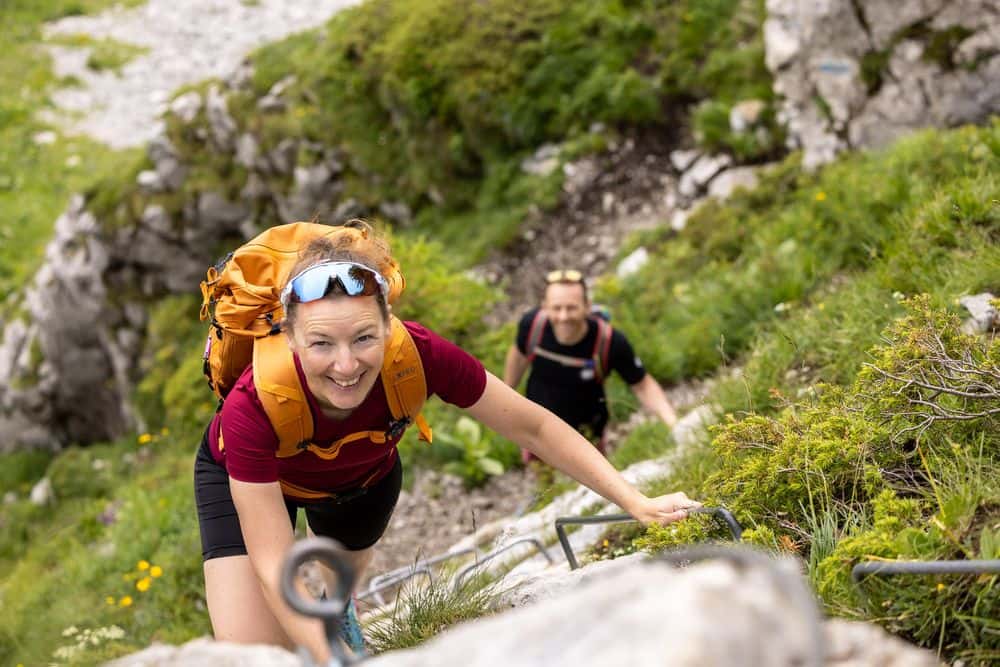
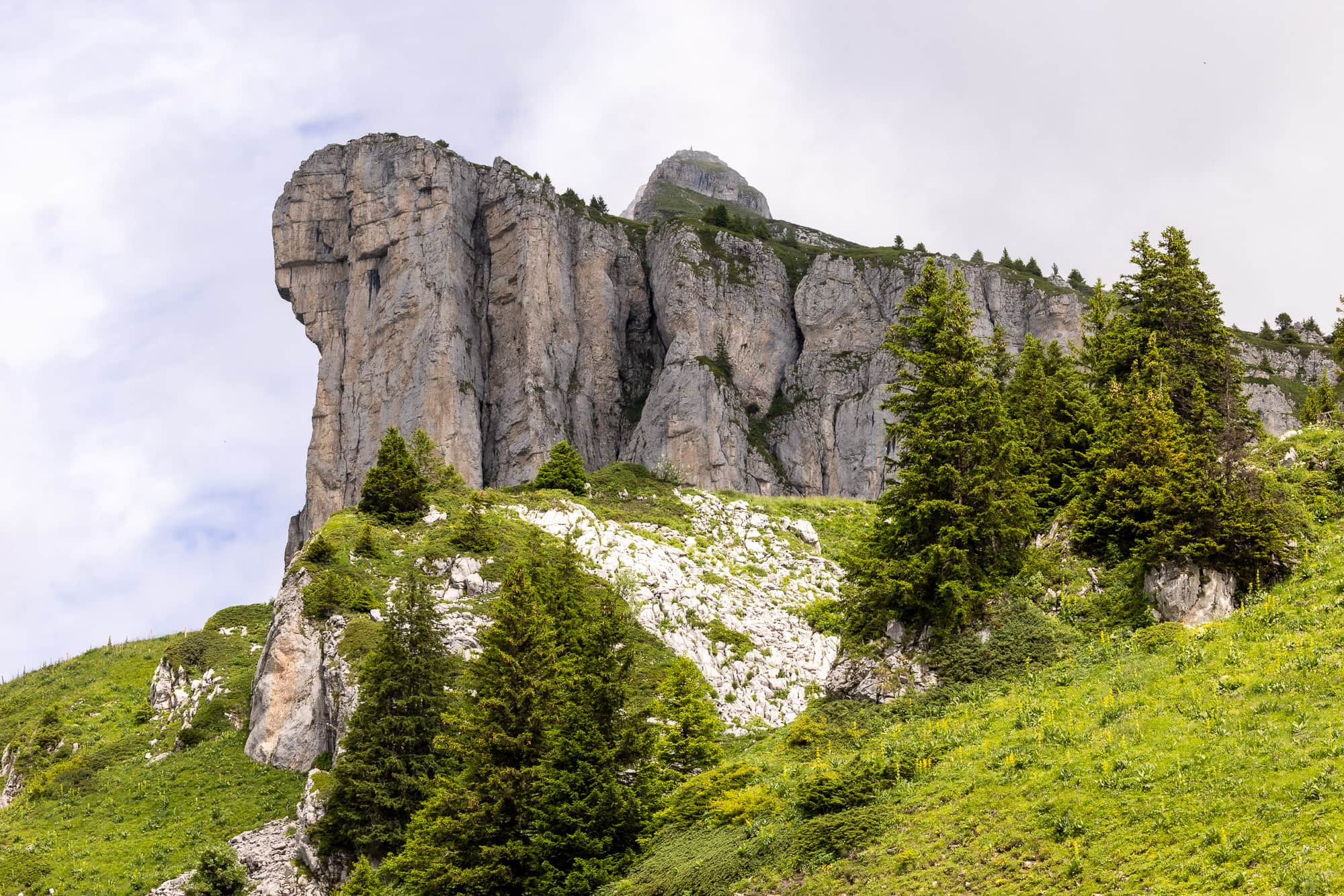
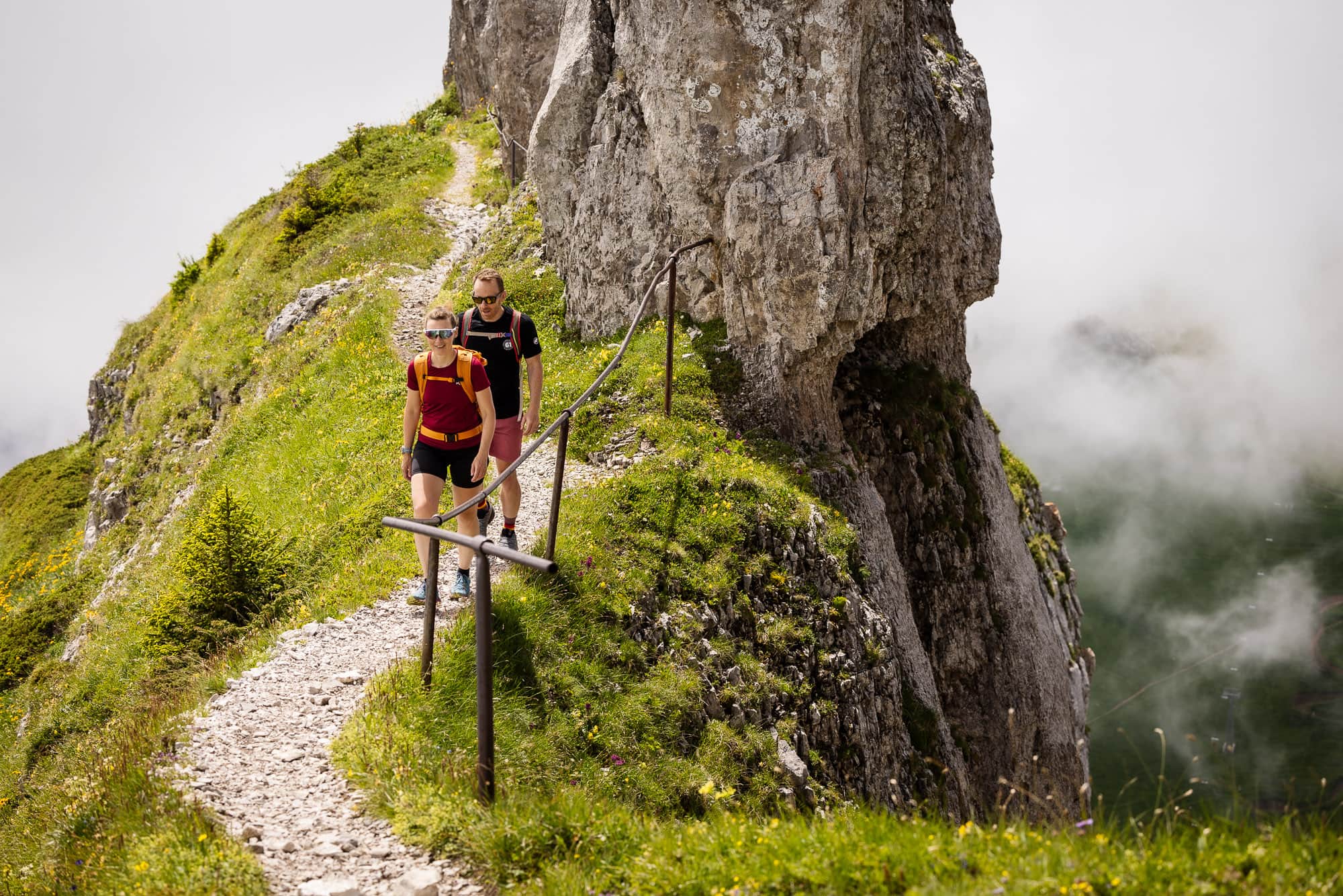
At 1,910 metres, we reach the Tête d'Aï and after a refreshment break, our route continues straight up a steep, rocky gully bordered by the long, grassy ridge of the Tour d'Aï. The path zigzags upwards, soon followed by the key section of the normal route on the Tour d'Aï, a short passage with two rocky ledges with metal cleats and steps. One is a little longer, the other only a few metres high. Our hands have to come out of our pockets, but our hearts don't have to slip into our trousers, because after just a few seconds this section is behind us and another colourful sea of flowers lies ahead.
Our courses
Experience the hike up the Tour d'Aï together with a hiking guide without any of the stress of planning and organizing.
Explore all hiking courses
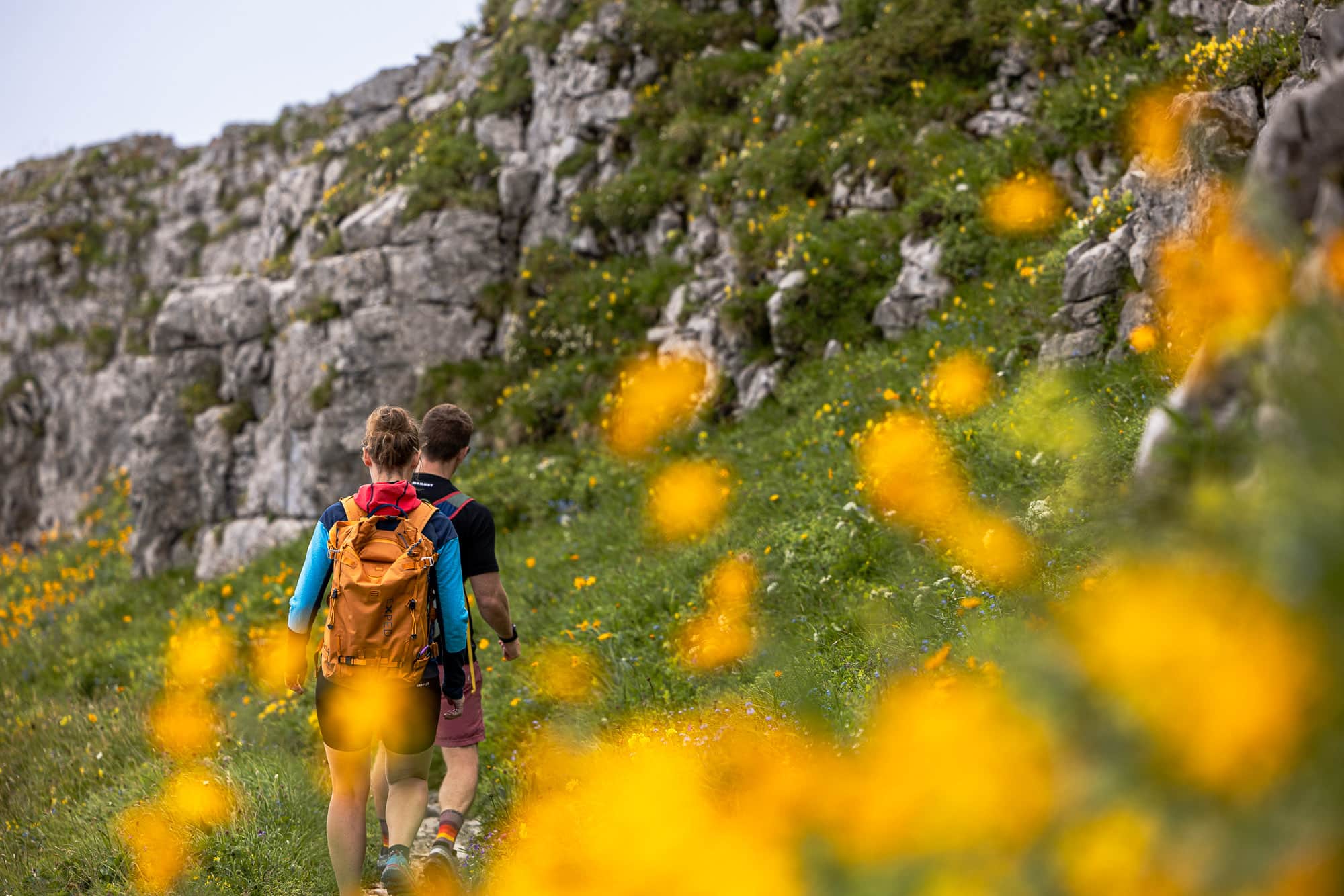
Yellow, blue, purple and pink, with a green mat underneath: this is how the following path up to the rocky summit of the Tour d'Aï presents itself. Thousands of flowers are lined up one after the other, and there are not quite as many hairpin bends, which quickly bring us to another short, rocky passage. Here, too, we have to make a brief effort before the path winds its way stealthily to the east side. We then climb the last few metres from the northern side up to the panoramic Eldorado of the Tour d'Aï.
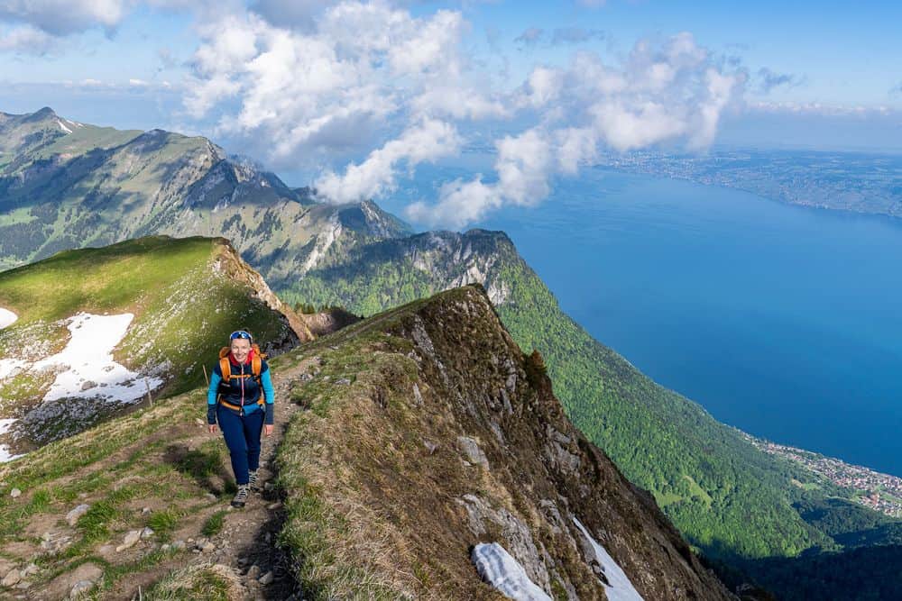
If this view from the summit of the Tour d'Aï isn't enough for you, you're probably beyond help. Lake Geneva, the foothills of the Alps and, in the other direction, mountains, mountains and more mountains. Low mountains and high mountains, even the highest mountain in the Alps, Mont Blanc, is not to be outdone and sends greetings from its white summit cap of eternal ice. Its only slightly lower neighbour, the Grand Combin, is also unmistakably visible at the end of the Val de Bagnes. And in between, the granite peaks of the countless mountain giants around Chamonix, in the triangle of Switzerland, Italy and France. The silvery dome of the Berneuse glistens directly in front of us, also accessible by cable car and recommended photo point in the evening sun.
Eat, drink, look, even in a different order - we don't have to do much more here at the summit. But we shouldn't put down roots, because we still want to go down. And so the ascent is followed by the descent, again passing countless alpine flowers and quickly losing metres in altitude. A lift awaits at the Tête d'Aï, but we ignore it and instead descend in a left turn via Alp Mayen. And not so much later, we find ourselves back at the cowpat passage - but this time we get over it a little drier and a little later arrive on the tarmac road back to Leysin, on which we are soon seen trotting back to Leysin without having to pass any more alpine by-products.
Pure Spots.
Fine art prints from this location.


We looked for and found a striking summit - but above all, we were able to discover unique alpine flora that more than deserves the term ‘colourful’. It appeared unexpectedly, but it is usually these unexpected things that we remember and that turn a simple mountain tour into a lasting experience.