
Actually, the hike to the 543 m high Ryten with a view of the Kvalvika beach on the west coast of Flakstad was on our program today. But often it comes differently than planned – or it comes differently, because you have not planned.
Many parking lots at places of interest or starting points for popular hikes in Lofoten are subject to a fee. In most cases, the fees are paid either in cash or by Vipps, a digital payment system reserved for Norwegians. We simply forgot this in our planning and the parking lot in Innersand is of course no exception. Norwegian kroner or euros in our wallet? Unfortunately, no. 🤦
So we are a bit annoyed with ourselves and retreat, because not paying is also no solution.
Moltinden – a spontaneous plan B
We quickly need a replacement program to take advantage of this perfect sunny day. A challenge for me, because I prefer to know two days in advance where we are going, how many meters of altitude await me and what else there is to know. But now spontaneity is called for.
A bit haphazardly we leave the parking lot at Innersand and drive off. Shortly before Ramberg we spot a hiking trail on a mountain slope and think: That or none. So we pull our backpacks out of the van and just start walking. Destination? Still unknown and I’m curious what we find up there.
First wet, then steep
The Lofoten Islands and in general many coastal areas in Norway often offer exactly two different conditions for hiking trails: either they are really steep or they are wet and boggy. Sometimes both at the same time, but then it’s no fun at all.
But in the ascent to Moltinden it’s one after the other: first wet, then steep. Before we find the hiking trail we spotted from the road, a relatively flat stretch of meadow awaits us. So close to the coast we naturally encounter the typical swampy Lofoten landscape. With stork steps we wade through the calf-high undergrowth and try to prevent our hiking shoes from being flooded. This probably looks just as “graceful” as you imagine it in your mind’s eye right now. Two jumping jacks on tour.
Maybe not really elegant, but with dry socks and feet we reach the longed-for hiking trail. A small path, on which we don’t fiddle for long – the transition from flat marshy terrain to “damned, is that steep here” is really remarkable. Partly, the now rather stony path leads dead straight up the slope and at least with me already pinch after a few minutes clearly the calves. Both Norwegian hiking trail clichés fulfilled within a few minutes. Step by step we leave the road below us and climb in monotonous steps further and further up.
Sandwiches gone, bellies full
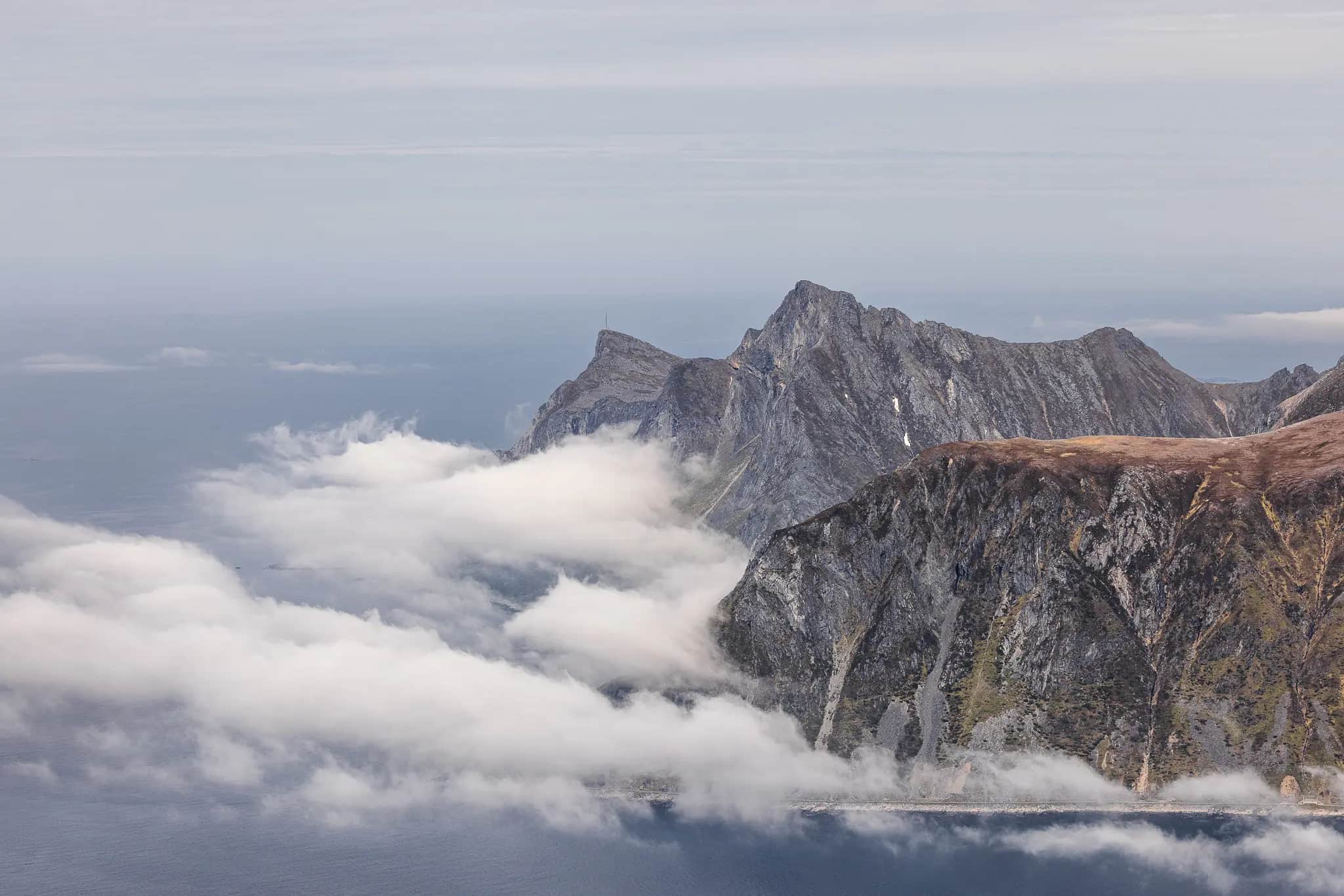
The climb has made us hungry and we treat ourselves to an extensive break with plenty of provisions, plenty of wind and plenty of views. The remnants of snow on the opposite slopes of Fuglhuken, Ryten and Moltinden (several mountains probably bear this name 😄) are melting in the early afternoon sun and the plain in between looks like a model railroad landscape – only without a train. Instead, with cars that seem tiny from up here, meeting on the roads and driving over the curved bridges that connect the small islands.
However, we are curious about the views that await us further up there and decide to go even further. So we shoulder our backpacks again and follow the trail tracks uphill.
I call them “teeter-totter floors.”
For a short while, the trail continues a bit flatter and we encounter the typically Norwegian soft hiking soils. Slightly damp, but not wet, and interspersed with countless roots of blueberry and juniper bushes, they cushion every step and give me that very special feeling of lightness when walking and hiking.
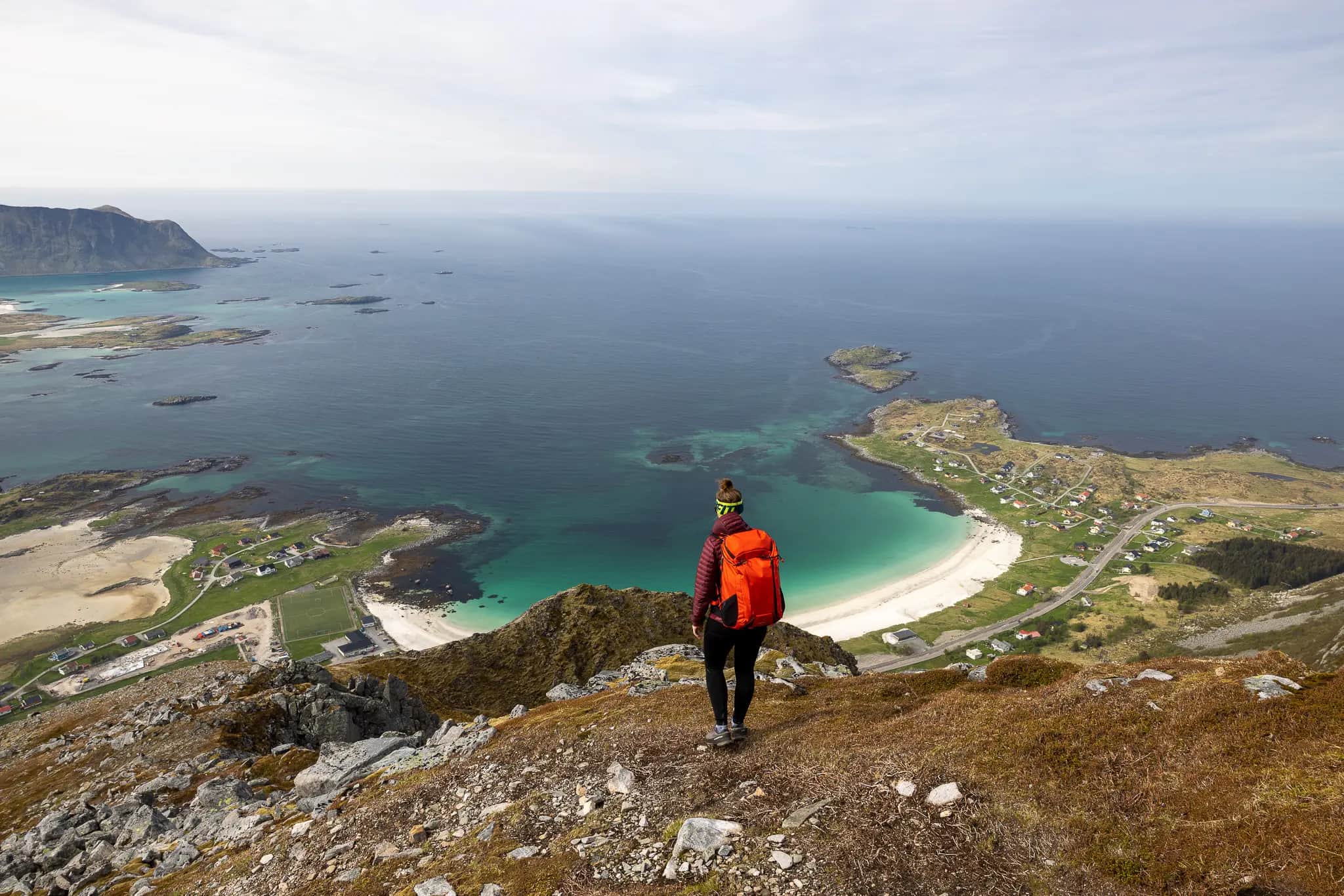
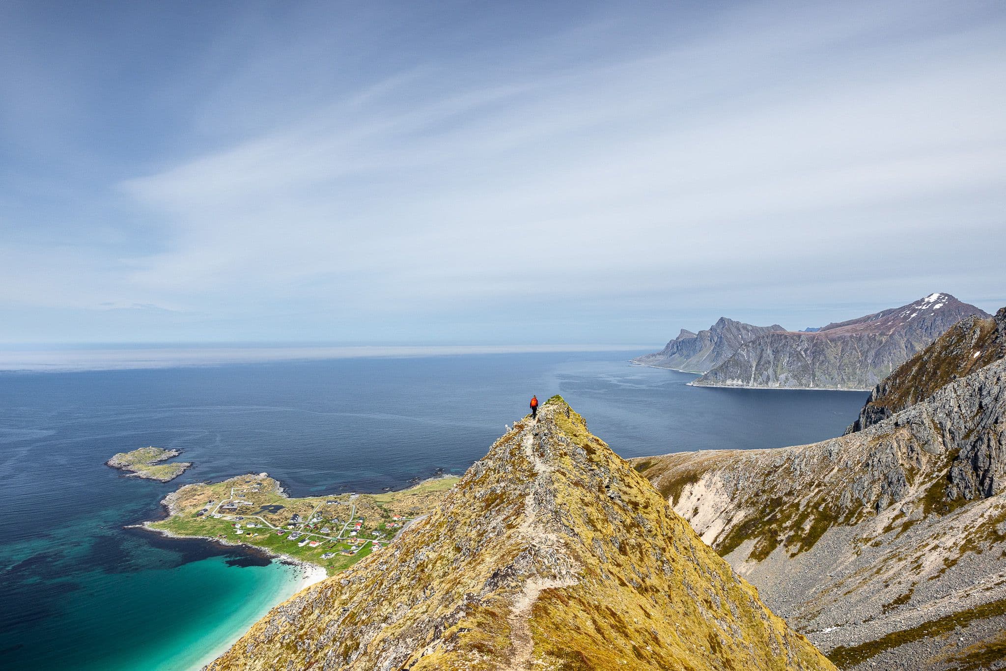
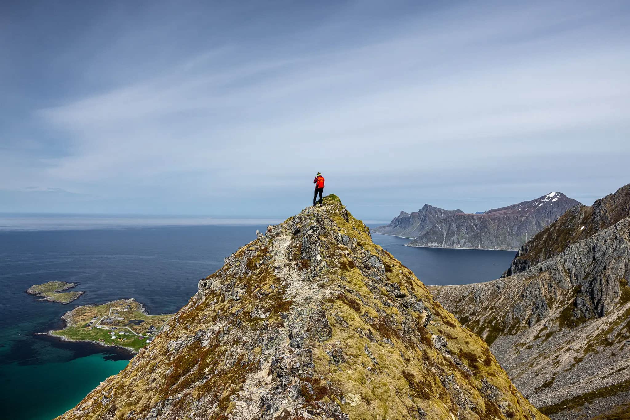
So, teetering, we reach a rocky spur that rises imposingly out of the actual massif and towers over Ramberg like a natural but somewhat narrow viewing platform. The narrow trail on the narrow ridge demands a sure footing and my heart rate comments on the view into the abyss below me at the same time. But the courage I muster to walk all the way to the front is rewarded and while the dredging noise from Ramberg resounds up to us from the valley, the view of Ramberg down knocks our socks off.
However, the view in the other direction, up the mountain (by now we know that the peak above us is Moltinden) tells a different story.
Panorama deluxe
In a steep zig-zag, the hiking trail winds monotonously through scree slopes until we finally reach the stem of the summit at Moltinden almost 700 meters in altitude after our departure. The last meters that separate us from our goal lead up over grass steps and stone blocks in exposed terrain. I hesitate briefly and send Falko ahead. For him, of course, no problem and enough to awaken the ambition in me. 😄 I need a bit of courage to dare to cross the narrow path to the main summit, but actually it looked more difficult than it actually is. And the courage was more than worth it.
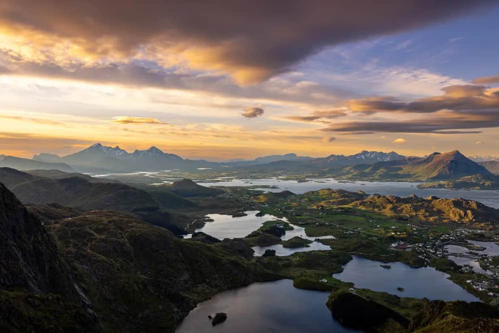
30 seconds later and a breathtaking 360° panoramic view richer we stand together on the summit of the Moltinden and I can hardly believe what view spreads around me here. As a little brother of the more than 160 m higher Stortinden, the Moltinden actually appears only moderately imposing from the valley. From above, however, this inconspicuous hill trumps with incredibly spectacular views in every conceivable direction. That’s what I really call panorama deluxe!
Our eyes roam over the peaks of Flakstad, wander across Solbjørnvatnet, meet Volandstinden and dive into the narrow Nordfjorden. We are overlooked by Stortinden and marvel at the sight of the presumably 800 m high and platy rock face into which it breaks off. Just below, the Flakstadpollen with its interesting coloring and bicolor structure captures our attention. And just below us lies Jusnesvika and the Caribbean-like beach of Ramberg.
Although a strong wind is blowing around our ears and in the meantime we have brought out our windproof jackets, I think we stand here for at least half an hour, taking pictures and marveling. Again and again we turn around ourselves and can’t get enough of the countless impressions that are coming at us from every direction.
Plan B – a complete success
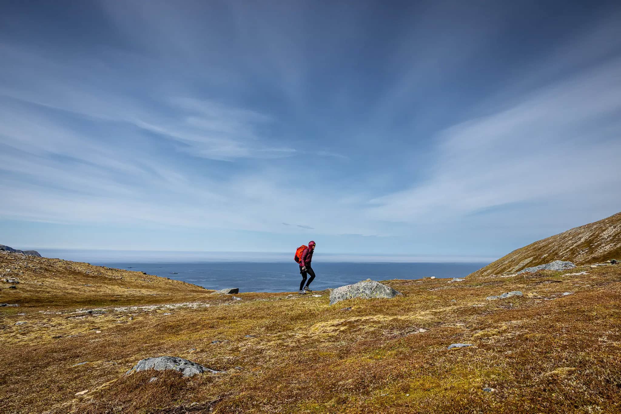
We would prefer to just sit here, but at some point every summit experience comes to an end and the steep descent is still breathing down our necks. Meanwhile accustomed to the steep break-off edges around me, the short and exposed passage to the pre-peak back now works much easier and shortly thereafter we are already back in the middle of the steep flank. Still under the spell of the panorama around us, we follow the zigzag back towards the valley and with every meter we lose in altitude, the wind also becomes less. Soon the jackets disappear into the backpacks and the joy of the summit gives way to a contented tiredness in our legs.
A pack of Kanelboller is waiting for us in the van – the perfect plan B when there is no café in sight to end a wonderful hike in a fitting manner.