They look like fossilized glaciers. Cracks, holes, crevices and chasms that suddenly open up: karst areas are the rocky counterpart of the icy glaciers that flow down from the high peaks into the valley. Unlike glaciers, however, karst areas do not move. They lie there silently, full of mysterious, dry stillness and evoke a wide range of emotions between amazement and respect. Amazement at the almost unreal landscapes created by the fissured rock and respect for the dangers posed by the cracks, crevices and sinkholes in the limestone.
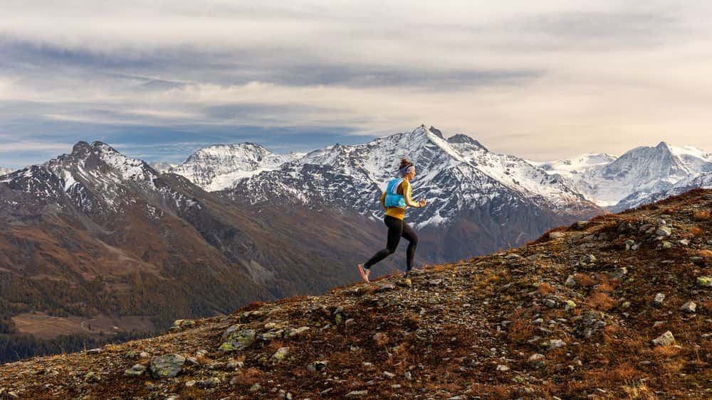
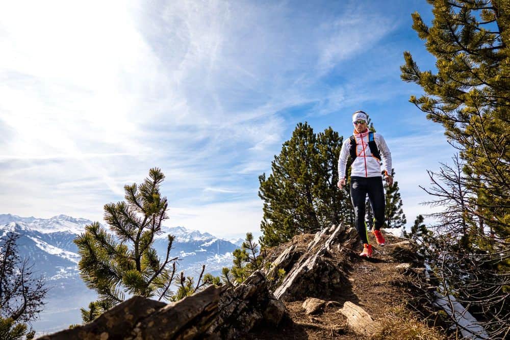
After completing the spectacular ride from Sion up to the 2,252 m high Sanetsch Pass, I start my trail run to the Cabane de Prarochet with a short descent. My ascent to the hut starts at the hamlet of Zanfleuron, which consists of just a few buildings, via the Lapis de Zanfleuron karst plateau - a run that will take me right into the heart of this unique landscape to the east of Les Diablerets at over 3,000 m altitude over the next few kilometers, with a total of around 800 metres in altitude.
Karst areas are mainly formed in limestone regions where the run-off water contains natural acids that slowly dissolve the rock. Regions known throughout the Alps are the areas around the Silberen in central Switzerland or the Tote Gebirge in Austria around the Dachstein, which is famous and notorious for its huge sinkholes.
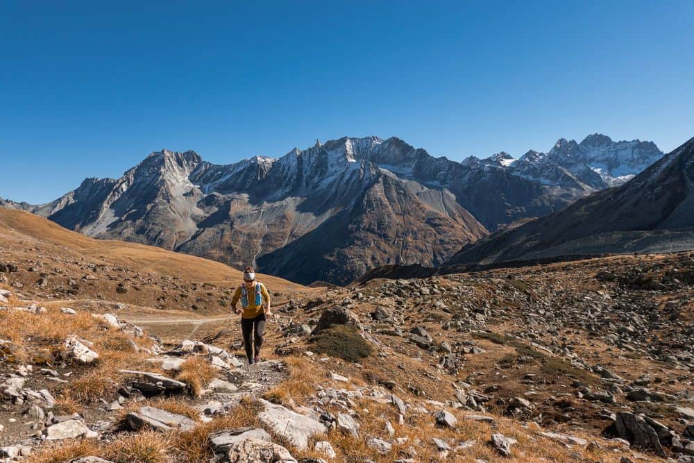
Below the Glacier de Zanfleuron, a fascinating landscape of rock formations stretches out around the Cabane de Prarochet. The structures that can be found here seem almost like something from another world, formed by the irrepressible force of the ice and the tireless effects of the weather. The upper part of the rocks, hidden under a thick layer of ice until a few years ago, shows gently rounded and smoothly polished surfaces. Further down, however, where the rock was exposed by the ice thousands of years ago, the brute force of erosion is revealed in all its glory. A typical karst landscape has formed here over the course of time: Deep, intricate cracks run through the rock and dangerous sinkholes lend the terrain a mysterious depth.
The hiking trail seeks the path of least resistance through this scenery reminiscent of a fossilized glacier. Instead of crevasses, I find deep rock cracks, instead of glacial mills, sinkholes, occasionally decorated with sparse vegetation, which looks all the more picturesque in this hostile environment. Despite the relatively short distance and elevation gain that I will cover on this run, I find the running challenging. The sharp-edged rocks and constantly changing ground require concentration, and the rough surface makes me fear that the soles of my running shoes will be ready for the dustbin after this venture. Schrattenkalk like this is ideal for rock climbing as it provides a lot of friction for climbing shoes. For the rather thin-soled trail running shoes, on the other hand, there are better things I could do to them.
But I'm not here to take it easy on my shoes. I want to get to know the landscape and walk from this side to La Tour St-Martin, which drops off steeply to the south, outside the winter season. Why outside the winter season? Well, Les Diablerets is a large ski area above Gstaad and, under the name Glacier 3000, is particularly busy in winter. It's hard to find peace and quiet here (and trail running is of course not possible at 3000 m altitude in winter).
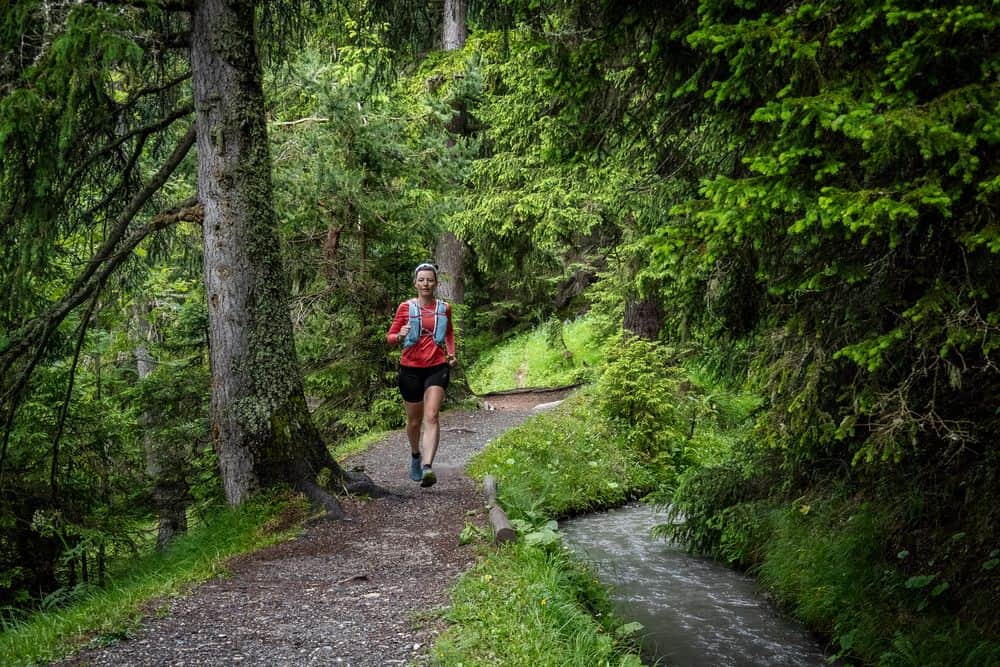
After the hiking trail initially meandered through small valleys overgrown with plants, I have now left this area behind me. The landscape has changed somewhat and huge karst areas dominate everywhere, torn apart by countless crevices and water grooves. Every now and then I pass a deep sinkhole, where a quick glance into it reveals no bottom. It is one of the main dangers of these sometimes really deep holes in the ground: in winter, when there is snow, they are covered in snow and barely recognizable. The danger is therefore similar to that of breaking into a snow-covered glacier and falling down. The former head of safety research at the German Alpine Club, Pit Schubert, has described impressive examples in the books he published entitled “Sicherheit und Risiko in Fels und Eis” (Safety and risk in rock and ice), in which people have found themselves in absolute borderline situations on solo climbs and only survived with a huge portion of luck - or not. The SAC also describes examples of minor but also fatal falls in sinkholes. The most important rule is therefore never to cross snow-covered karst areas alone unless you can be absolutely sure that you are still on the marked path.
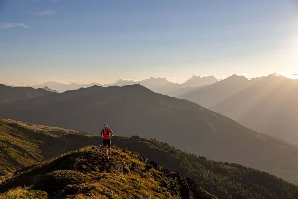
While I imagine creepy scenes with endlessly deep holes and clattering skeletons clad in functional clothing at the bottom, I reach the Cabane de Prarochet in the middle of this rocky desert. It is almost indistinguishable from its surroundings, the small hut blends in so perfectly with the karst landscape. From here, the route will take me another 400 meters up to the foot of the striking Tour de St-Martin, a 2,907 m high rocky spire that towers over the Rhone valley and drops southwards in steep rock faces into the valley to Derborence. Right next to this rock tower is the Refuge l'Espace with spectacular views to the south, which is my final destination and highest point for this run.
While the hiking trail up to Cabane Prarochet was still reasonably easy to recognize, this now changes. You have to look carefully not to miss the white-red-white markings, although it's almost impossible to get lost here, at least when visibility is good - the Tour de St-Martin's rocky crag looms too prominently in front of me. Nevertheless, it is advisable to stay on the route, as otherwise you will quickly find yourself in front of several-metre-high limestone ledges, some of which are difficult and can only be overcome with some easy climbing.
I realize that I am entering an area of the landscape that was covered in glacial ice not so long ago. While the stony surface was previously swept clean, so to speak, there is still a lot of debris lying around here that has been transported by the ice over many years. Arriving at Refuge l'Espace, the clouds suddenly thicken and the wind pushes thick clouds onto the Tsanfleuron plateau from the south. And even if no permanent fog cover forms, I'm still glad I have my GPS track, because the way back in the fog would clearly be very difficult without orientation.
I soon start my way back and run back to the Cabane de Prarochet, from where I choose a path further north for the rest of the descent, which will lead me in a curve back to my starting point at the Sanetsch Pass. I have to descend around 200 meters before I can leave the huge limestone plateau and continue on a “normal” hiking trail. It is advisable to tackle this trail run in a clockwise direction, as this allows you to tackle the more technically demanding part in a slower ascent, while on the descent you run quickly on the flowing hiking trail towards the Sanetsch Pass. After a few kilometers, the path under the rocky precipices of the Sanetschhore brings me to the end of my run and from the top of the pass, all that awaits me now is the scenic ride back down to the Rhone Valley almost 1,800 m below.
The round tour via Cabane de Prarochet is a scenically impressive and not quite everyday trail running route directly opposite the no less exciting hike to the over three thousand meter high Arpelistock, which is not necessarily impressive in terms of its length and altitude, but impresses with its scenic attractions and challenges runners technically. If you prefer, you can even skip the return journey, take the cable car down to Les Diablerets and then return to your starting point by public transport.